

Most of us have likely heard of the term "Smart City," but what about "Smart Village"? What is the major factor that distinguishes the penetration of modern technologies developed by humans in rural areas?
Well, cities, as well as other urban areas, can be considered, under certain assumptions, as closed systems where interaction occurs mostly between rigid human-engineered elements. Technology is the foundation of cities. When discussing technology, it is hard to overlook Artificial Intelligence, which has infiltrated most aspects of our existence. Therefore, it is no surprise that in cities, AI is employed to optimize various aspects of daily life, from transportation and energy management to public safety and healthcare. Intelligent traffic systems use AI algorithms to alleviate congestion, while smart energy grids dynamically adjust resource distribution based on demand patterns.
What about rural areas then? What makes them so distinct from urban ones? First, let’s consider what distinguishes an urban area from a rural one. While cities appeared where they did due to some anthropogenic reasons, whether political, geographical, or historical, rural areas have developed in connection with the surrounding nature. Grasslands that later became pastures or crop fields, forests that initially were a source of game for hunters, or bodies of water that determined the initial locations of fishing villages. Thus, it would be fair to say that nature defines the rural area, and while urban areas are fully dependent on human-made infrastructure, rural areas are more vulnerable to uncontrolled human intervention due to their tight bond with the surrounding ecosystem.
The development of rural areas often depends on the human-nature balance, which can be easily disrupted, causing detrimental and irreversible effects on the surrounding environment. This, in turn, has a massive negative impact on the inhabited rural area, as it depends heavily on the nature around it.
Such relationships are often complex, nonlinear, and not always obvious at first glance. One of the most infamous cases is the introduction of cattle in Australia, where the native endemic ecosystem was unprepared for the goey cattle waste products, as no hoofed animals were present in Australia before. To address this problem, Australian authorities invited a Hungarian entomologist and ecologist, George Bornemissza, who analyzed the situation and decided to introduce dung beetles from Hawaii to deal with cattle by-products. The project is known today as the “Australian Dung Beetle Project''. Even though the problem was eventually solved, it took about 70 years to spot the problem and another 20 years to resolve it, leading to irreversible damage to the unique ecosystem, which is still evident today.
Therefore, it seems that the best way to solve such types of problems is to prevent them. However, it would require immense effort and resources to identify and forecast such dependencies in nature, as the existing balance is the result of 4.5 billion years of evolution of life on Earth.
Luckily for us, modern machine learning algorithms are very efficient at learning complex patterns and nonlinear behavior. They are not only able to take into account existing dependencies and patterns but can also elucidate new ones, given enough data to analyze. And since we live in the era of big data, we are blessed with all the tools and materials to find these patterns that can help us build a better interaction between rural areas and nature, as the former is a part of the latter.
In the PoliRuralPlus project, the abovementioned is one of the major goals. PoliRuralPlus is set to revolutionize rural development by leveraging state-of-the-art machine learning techniques. By analyzing data from diverse sources—such as weather patterns, earth observations, and local measurements—this innovative project aims to identify key indicators that are crucial for sustainable rural planning and development. These indicators will play a major role in informing decision-making processes, ensuring that policies and strategies are not only based on solid, evidence-based insights but also promote sustainability. PoliRuralPlus is dedicated to enhancing rural areas while preserving and benefiting the surrounding natural environment, since we strongly believe that a healthy natural environment is what defines a healthy rural area. By integrating advanced technology with a deep respect for nature, the project aims to create harmonious and sustainable rural communities.
The project plans to use state-of-the-art machine learning techniques not only to identify malicious effects on the natural environment but also to forecast a possible detrimental effect of planned changes in rural development. Therefore negative effects of urbanization can be foreseen and avoided. The PoliRuralPlus project is dedicated to evaluating the vital ecosystem services provided by rural and natural areas, while also exploring innovative ways to promote their sustainable use. By ensuring these ecosystem services are fully integrated into decision-making processes, the project aims to develop robust policies and strategies that enhance the resilience and attractivity of both rural and natural environments.
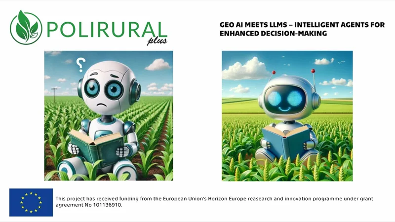
Another aim of the project is to harness the power of Generative AI to create an easy-to-use tool that combines large language models (LLMs) that are tailored to be able to analyze geospatial data. LLMs have recently shown immense progress giving the opportunity to utilize natural language for multiple decision-making tasks over a large volume of information. Textual or geospatial information can be analyzed by LLMs and give a user a high-level overview of the problem.
By leveraging the power of LLMs, the project aims to analyze and interpret vast amounts of textual and geospatial information, providing deeper insights into the complex interplay between rural areas and their surrounding natural environments.
LLMs can be employed to semantically enrich geospatial data by linking geographic features with relevant textual information. For instance, descriptions of land use, soil quality, and historical land changes can be automatically extracted from scientific literature, government reports, and local documents. By doing so, the project can create a more comprehensive dataset that not only includes raw geospatial data but also contextual information that is crucial for informed decision-making. This enrichment process helps in understanding the full scope of factors affecting rural development and environmental sustainability.
LLMs can assist in predictive modeling by analyzing trends in both geospatial and textual data, by examining weather patterns, crop yields, and local economic activities, LLMs can be used to predict and reason for future agricultural productivity and identify potential risks such as droughts or pest infestations, in a user-friendly manner.
However, despite the remarkable effectiveness of LLMs, they still fall behind more traditional lightweight models in terms of prediction modeling, such as working with tabular data or time-series forecasting. In this case, LLMs can be used as a tool to evoke another model and return accurate predictions to the user. This approach enables us to combine the best of both worlds: accuracy and user-friendly use.
Moreover using LLMs it is possible to provide natural language interfaces to geospatial databases. This allows stakeholders, including policymakers, researchers, and local communities, to query and retrieve geospatial information using everyday language. A user could ask for related information in a natural language and receive a detailed response based on the latest geospatial and textual data. This accessibility democratizes data usage, making it easier for non-experts to engage with and benefit from advanced geospatial analyses.
Overall, a key focus of PoliRuralPlus is the use of Nature-Based Solutions to drive sustainable development in rural regions. Based on the precise decisions of machine learning algorithms, the project will support the creation of natural spaces, such as parks and green corridors, which connect rural and urban areas, in the most efficient way. These green infrastructures will not only facilitate the movement of people, goods, and services but also promote the exchange of knowledge, culture, and innovation.
With PoliRuralPlus, the future of rural development looks smarter, more efficient, and deeply interconnected with environmental sustainability. This initiative promises to bring about positive changes that support both human needs and the health of our natural ecosystems.


Existing Comments