PoliRuralPlus Innovation Hub
State-of-the-art
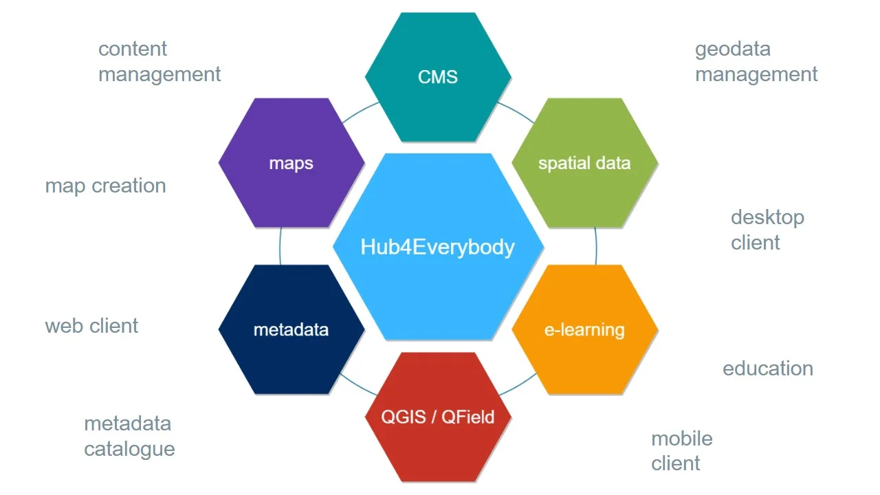
The PoliRuralPlus web portal is built on top of the Hub4Everybody platform. The cornerstone of this solution is a Wagtail CMS (Content Management System), enhanced by the Wagtail CRX library for rich editing capabilities by default.
Wagtail CMS is a modern, flexible, and powerful content management system built on Django, a high-level Python web framework. Key features include:
- User-friendly Admin Interface: An intuitive, streamlined editor interface for creating and managing content.
- Flexible Content Types: Allows the creation of various content types with custom fields and layouts.
- Rich Text Editing: Includes a robust rich text editor for formatting content.
- Image and Document Management: Built-in tools for handling media files with image cropping, resizing, and document storage.
- Forms: Support for rich forms to gather data or other inputs from the web users.
- SEO and Social Media Tools: SEO-friendly features and social media integration.
- Multilingual Support: Capabilities for managing content in multiple languages.
- Customizable Workflows: Workflow management for content approval processes.
- Scalability: Can handle websites of all sizes, from small blogs to large-scale portals.
eLearning Module Integration
A custom eLearning module has been developed for Wagtail CMS. Key components of the complex solution include:
- Course Management: Create, organize, and manage courses, lessons and chapters. Each course can include text, images, videos, maps and quizzes.
- User Enrollment: Manage user registration, course enrollments, and track progress.
- Interactive Quizzes: Add quizzes with various question types (multiple choice, short answer, etc.) and assignments for student evaluation.
- Certificates and Badges: Automatically generate certificates upon course completion.
- Discussion Forums: Facilitate student interaction and support through discussion forums connected with each course.
Interactive Maps Integration
Interactive maps can significantly enhance user experience, especially for educational content. This is achieved by integrating the spatial data management tools described in the “Spatial Data Management” technical pilot. Key features include:
- Publishing of custom datasets: Display different layers of information on the maps.
- Symbolize the data: Make the data look like you want to present their message.
- Compose maps: Combine different data sources to make thematic maps.
- Data Visualization: Integrate with data visualization libraries (e.g., D3.js) to display complex data on maps.
Technical Aspects and Possibilities for Extension and Integration
The CMS solution can be further extended regarding the needs of stakeholders. To implement such extension, various technical components and integrations are needed:
Wagtail CMS Customization
- Custom Content Models: define custom models for courses, lessons, and other eLearning components.
- StreamField: Utilize Wagtail's StreamField to create flexible and dynamic page layouts for course content.
- Custom Admin Views: Extend the Wagtail admin interface to manage eLearning-specific data.
Django Integrations
- Django Packages: Leverage existing Django packages for eLearning (e.g., Django LMS, Open edX) and maps (e.g., django-leaflet).
- Custom Django Apps: Develop custom Django apps for specific functionalities not covered by existing packages.
Frontend Enhancements
- JavaScript Libraries: Use libraries like React, Vue.js, or plain JavaScript for interactive components and dynamic content.
APIs and Services
- Dashboards: Integrate with dashboard systems like Superset or Grafana.
- Payment Gateways: Use APIs from Stripe, PayPal, etc., for handling course payments.
By leveraging Wagtail CMS’s flexibility and Django’s robust ecosystem, along with powerful integrations for eLearning and interactive maps, a comprehensive and engaging web portal can be developed. This solution can be extended and customized to meet the specific needs of educational institutions, training organizations, and content creators.
PoliRuralPlus objectives for extension
For the Hub4Everybody platform under the PoliRuralPlus project, a principal objective is to enhance its capabilities through the integration of sophisticated dashboards and advanced AI analysis tools. This integration aims to transform the platform into a more dynamic and powerful tool for spatial data management and decision-making.
The incorporation of dashboards will provide users with customizable visual interfaces, enabling them to view, analyze, and interact with data more effectively. These dashboards will be designed to aggregate data from various sources, presenting it in an intuitive format that facilitates quick insights and real-time monitoring. Key features will include interactive maps, graphs, and statistical displays that are essential for comprehensive spatial and data analysis. Simultaneously, AI analysis tools will be integrated to augment the platform’s analytical capabilities. These tools will utilize machine learning algorithms to perform complex analyses, such as predictive modeling and trend analysis. The AI functionalities will automate the processing of large datasets, enhancing the platform’s efficiency and enabling more sophisticated data interpretation. This will support users in making informed decisions based on the latest data insights. Overall, the integration of dashboards and AI analysis into the Hub4Everybody platform is designed to significantly enhance its utility for all stakeholders involved in rural planning and development. By providing powerful tools for data visualization and analysis, the platform aims to foster a more informed and proactive approach to rural development.