MapWhiteboard
State-of-the-art
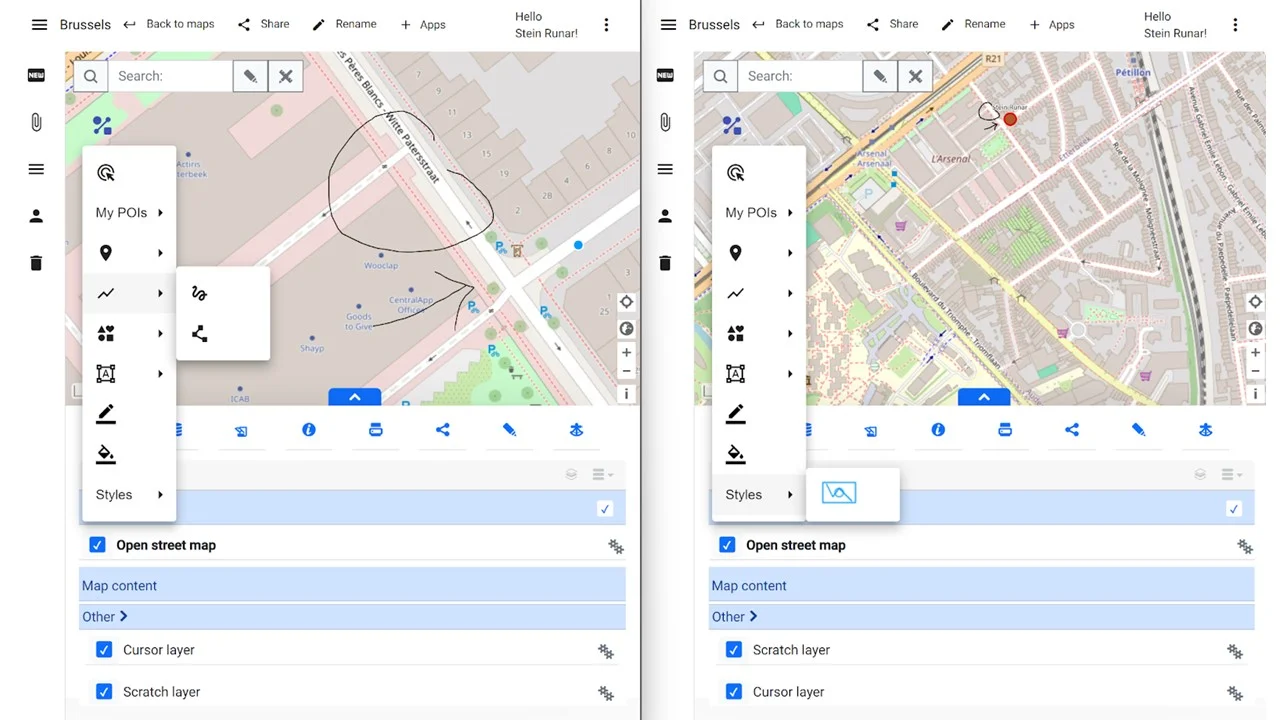
MapWhiteboard technology is a component that enables shared map browsing and spatial data editing much the way popular online conference experience augmentation tools like Miro and Figma does for generic digital whiteboard workflows such as drawing diagrams and creating massive canvases of “stick-it” notes from brainstorms.
Practically, it integrates a traditional web GIS client with basic add/show layers, add/edit data functionality with a web sockets server that listens to events in the users maps. These events are then exchanged among clients connected to the same map so that a layer added by user A will be visible in the map of user B - and so that the cursors of the individual users are visible to one another, greatly facilitating the process of collaborating in/over a map.
The features presently include:
- Pre-defined maps configured with background layers and editable layers
- Support for upload/download of GeoJSON
- Support for upload of WMS layers
- Support for shared cursor locations
- Shared editing of features in predefined editable layers
- Creating new editable layers
- Editing feature attributes
- Possibility to publish geometries/features into layers from third party applications through web services
Technically, the solution consists of:
- A JavaScript extension layer for OpenLayers that attaches itself to the event model of an OpenLayers Map and listens to and propagates map and layer events accordingly
- A Server that implements a WebSocket message API to handle communication within a map context - and a second Rest API to store and manage maps, data etc.
- A web application that implements the library and server based on HSLayers NG, a fork of OpenLayers built by CCSS
PoliRuralPlus objectives for extension
The MapWhiteboard has been an idea a long time in the making and it has had what one might be forgiven for calling a slow birth. Originally conceived in 2017, it is still merely at TRL7. Not due to lack of technical completeness; rather because of difficulties in identifying how best to integrate MapWhiteboards into the short of solutions and workflows people, i.e. PoliRuralPlus users in provinces and municipalities, are familiar with and can relate to.
The ambition during PoliRuralPlus will be to put the existing technology to work and to integrate it with AI-tools and generic geoportal and Web GIS tools presently used so that we may capitalize on the benefits of the technology. No massive efforts in further development of the concept are foreseen.