
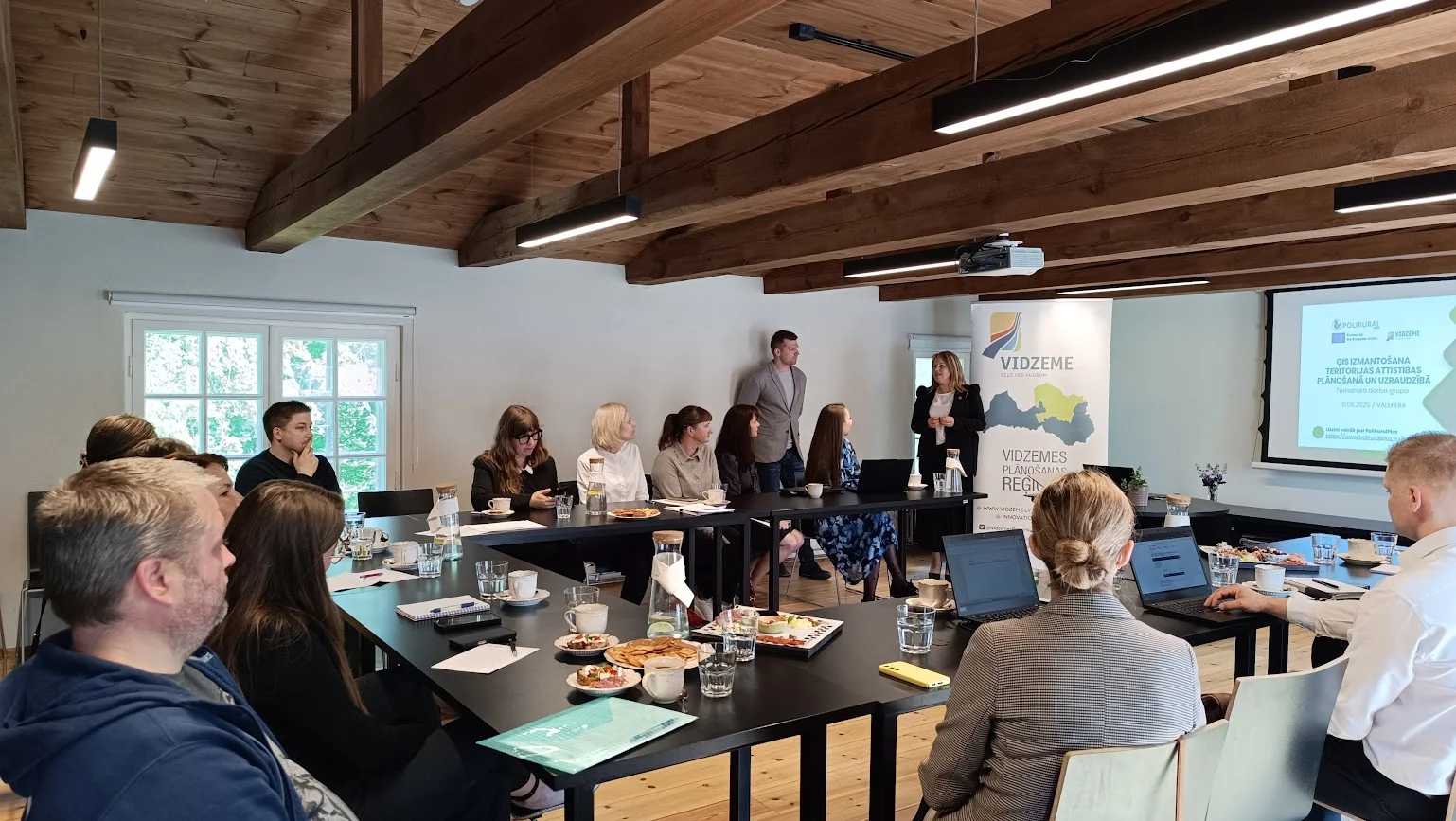
This summer, the Vidzeme Planning Region has been marked by a targeted effort to reinforce data-driven territorial development planning. In cooperation with Valmiera Municipality, a thematic working group meeting titled "Use of GIS in Territorial Development Planning and Monitoring” was held on 10 June 2025 in Valmiera. The event brought together regional and municipal planning specialists and Geographic Information System (GIS) experts to exchange experiences on the effective use of geospatial data in everyday municipal work and planning, with the aim of promoting evidence-based decision-making and improving decision quality.
The event reflected the project’s overarching ambition to support regional stakeholders in applying integrated, data-driven planning methods that enhance rural-urban development synergies – one of the core dimensions of PoliRuralPlus.
At the event, Valmiera Municipality shared its experience in developing and operating a municipal GIS system. Despite limited staffing, the municipality has established an extensive GIS infrastructure that supports a wide range of internal processes and provides several public-facing digital tools for residents. These applications help visualise data related to public services, infrastructure, and territory management, improving transparency and operational efficiency.
The municipality also presented solutions for digitalising data collection, including the use of drone technologies to support public safety, construction monitoring, and territory management. The collected data is integrated into the municipal GIS system, supporting further developments such as digital twins and spatial data modelling.
Discussion highlights: challenges and solutions in GIS implementation
During the discussions, participants emphasised that GIS should be more than just a data storage tool – it must actively support data-driven decision-making. However, in many municipalities, GIS is still underused for analysis. To unlock its full potential, it is important to integrate GIS into daily work processes and demonstrate its practical value across departments. As noted by local experts: “Geospatial data does not lie.”
The importance of applying GIS not only for operational tasks but also for strategic planning was also highlighted. GIS can support well-informed decisions on service accessibility, mobility, and spatial development, enabling timely and fact-based responses to territorial changes.
Representatives from the Vidzeme Planning Region presented a regional perspective on how monitoring data can be better aligned with municipal needs and emphasised the importance of integrating data use into everyday workflows.
The Vidzeme Development Programme 2022–2027 includes 128 monitoring indicators, 20 of which are based on data sourced from municipalities. To ensure that these indicators effectively support regional monitoring, they must be comparable, preferably geospatially visualised, and based on a clear methodology with data available at the lowest possible territorial level (e.g., parish and village).
During the meeting the Vidzeme Planning Region emphasised the importance of harmonising monitoring data across municipalities to enable meaningful comparisons and support regional-level planning. While some municipalities apply compact indicator systems and others more detailed frameworks, there is growing recognition of the need for a shared set of indicators and methodologies. Geospatial visualisation and accessibility of data at the local level are key for effective monitoring.
Vidzeme sees its role as a coordinator in aligning data efforts and fostering a common perspective on territorial development – serving as a bridge between the local and national levels.
Participants also noted that GIS specialists often play a key role in driving change within organisations by demonstrating the practical value of geospatial tools and inspiring wider engagement. As highlighted during the discussion: “If there is a story, GIS will listen and find a way to address it. What matters is having political support at the conceptual level.”
The experience shared and discussions held during the meeting in Valmiera contribute to the broader goals of PoliRuralPlus by advancing regional capacity in spatial data use, fostering alignment between municipal and regional monitoring approaches, and creating preconditions for more coherent territorial governance practices. These insights will feed into the development and validation of integrated planning tools promoted by the project.
As part of the PoliRuralPlus project and in response to the Mobilise Open Call, a hackathon will take place in the Vidzeme Planning Region on 3 and 19 September 2025. Organised by the call winner Novafutura, the event will bring together municipalities and other stakeholders to co-develop a prototype for a development monitoring mechanism. The initiative aims to strengthen the culture of data use and promote evidence-based territorial governance in Vidzeme.


Existing Comments