A rural area may have an active cultural life, beautiful natural destinations and a full calendar of community events—and still appear almost empty online.
Information may be divided between social-media posts, noticeboards, municipal calendars, association websites and personal networks. Residents often know where to look, but visitors and newcomers do not. Even local people can miss activities taking place only a few kilometres away.
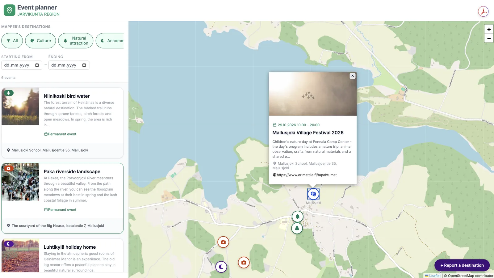
The Activity Map developed in the Avoin Map project addresses this simple but important problem: how can locals post rural events, attractions and year-round activities into a service that is easy to explore and realistic for local organisations to maintain?
Visibility is part of rural vitality
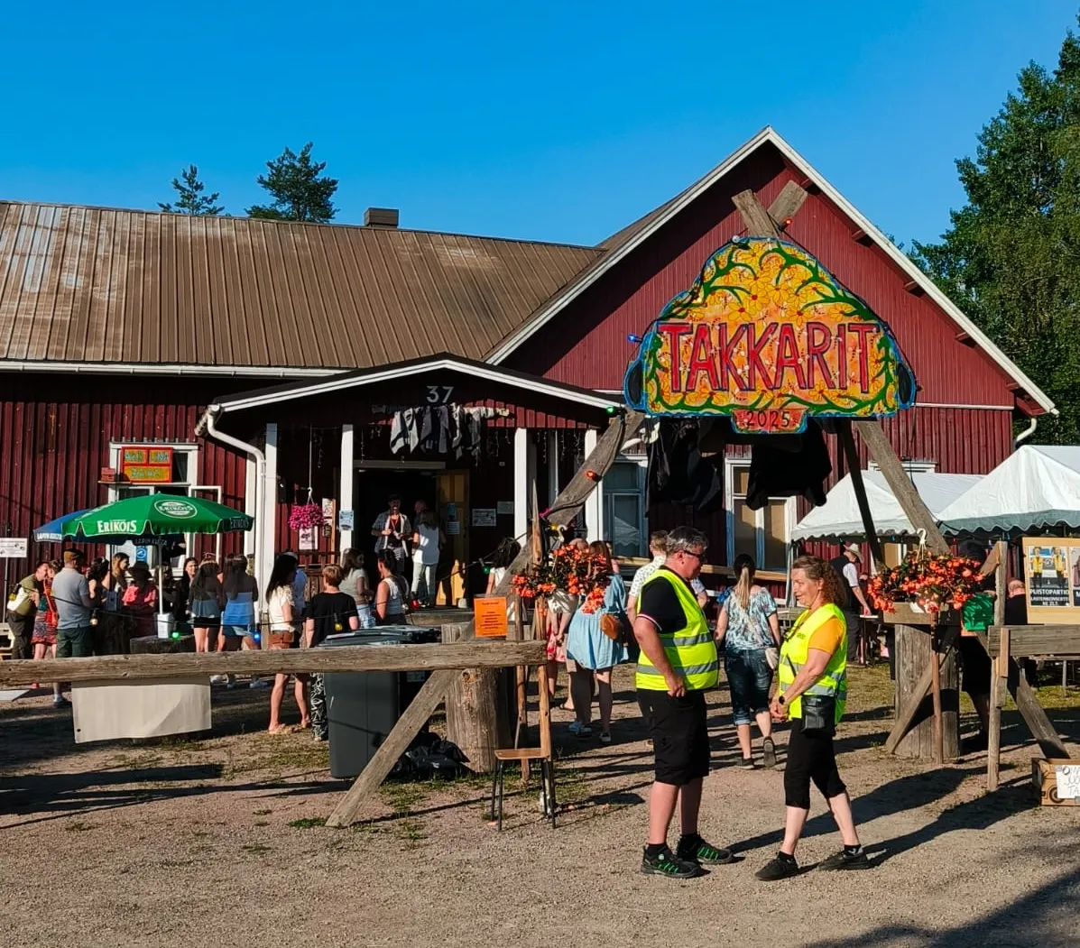
Image taken at the Takinkääntöviikko festival in Mallusjoki, Finland, in 2025.
Rural areas cover approximately 83% of the EU’s territory and are home to around 30% of its population. They contain much of Europe’s natural and cultural heritage, but many also face ageing populations, outward migration, limited services and weaker connections to surrounding economic centres. These challenges are recognised in the EU’s Long-term Vision for Rural Areas.
Events and shared activities cannot solve these structural issues alone, but they contribute to the social and economic fabric that makes a place attractive. A concert, village celebration, nature excursion, exhibition or volunteer event can bring people together, support local businesses and give visitors a reason to travel beyond established tourism centres.
European tourism is large and still growing. Eurostat recorded approximately 2.99 billion nights in EU tourist accommodation in 2024. However, tourism demand is unevenly distributed, and many smaller places remain difficult to discover even while heavily visited destinations face congestion and seasonal pressure.
Better visibility for local activities can help direct attention towards less familiar places and encourage more varied, year-round travel. The aim is not to turn every village into a mass-tourism destination. It is to make existing cultural, natural and community assets easier to find on terms that also benefit local people.
From scattered posts to a shared view
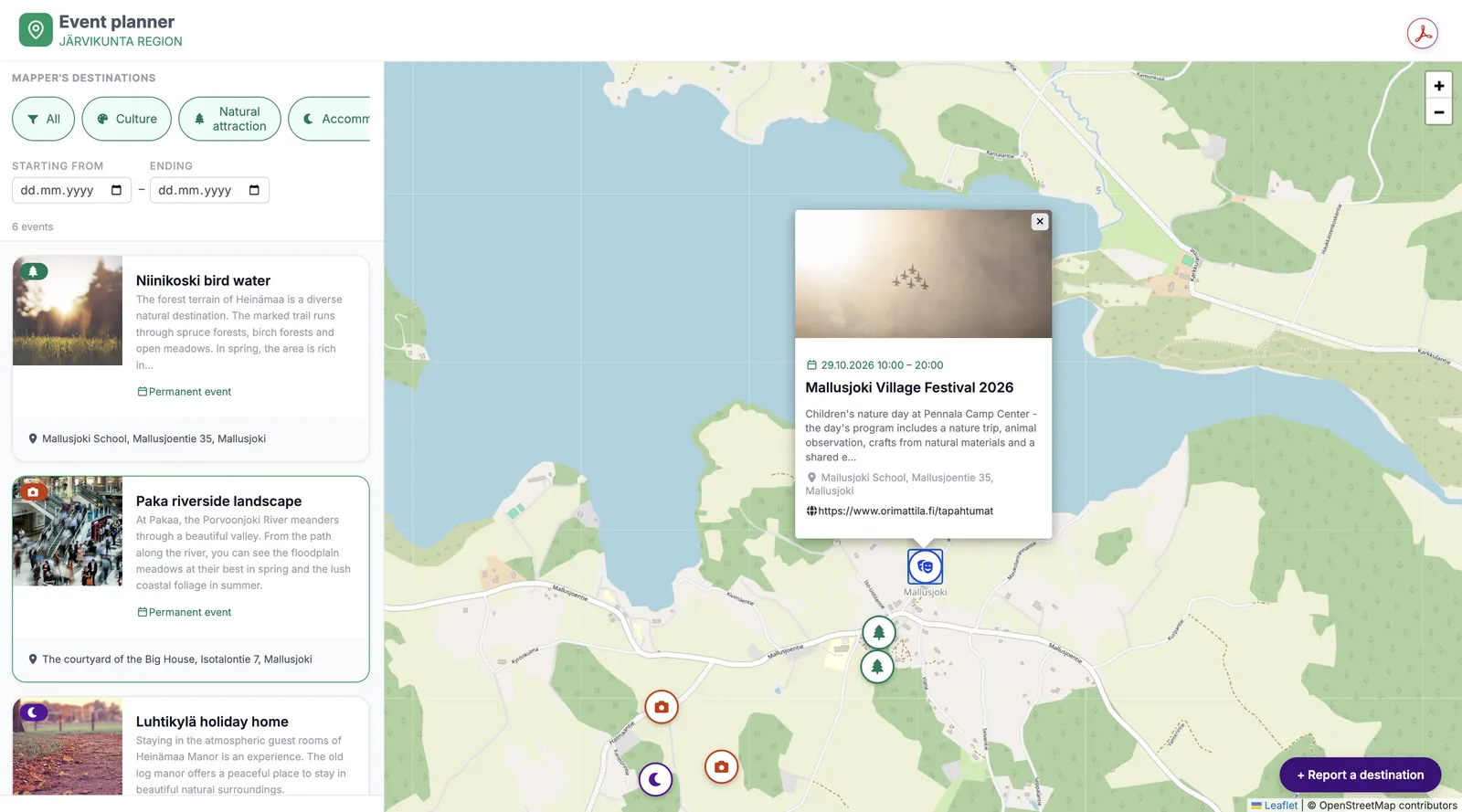
Image: The Activity Map web service centred on the Mallusjoki pilot area in Finland, demonstrating events and destinations in a shared map view.
The need for an Activity Map was identified through discussions and co-creation in the Mallusjoki pilot region. Local events and attractions existed, but their information was distributed across several channels and was not always accessible to visitors from Orimattila, the wider Päijät-Häme region or nearby urban areas.
During the project, Avoin Map Oy worked with the Mallusjoki Youth Association, the City of Orimattila and the Päijät-Häme Regional Council. These discussions shaped the scope and design of the service.
Stakeholders stressed that a new platform should complement existing municipal and regional calendars rather than reproduce them. It should support many kinds of content, from events and cultural attractions to nature destinations and year-round activities. Adding information should be simple, while moderation should keep the service useful and trustworthy.
The resulting Activity Map combines a visual map, event information, and category-based browsing. It provides a common entry point through which residents and visitors can explore what the area offers and understand where activities take place.
The Mallusjoki pilot has demonstrated that the technical map is only one part of the solution. Equally important questions concern ownership and everyday maintenance: Who checks the information? How does the service exchange information with existing calendars? These are not secondary details. They determine whether a service remains useful after its initial launch.
Digital access is improving, but discoverability matters
Europe’s rural digital divide has narrowed, but it has not disappeared. According to Eurostat, 91% of rural EU households had internet access in 2023, compared with 95% in cities. Differences were also visible in how people used the internet: 59% of rural residents read online news, compared with 70% of city residents.
Connectivity is therefore only the first step. People must also be able to find relevant content, understand it on a mobile device and trust that it is current. A technically advanced service will have limited value if submitting an event is difficult or if local organisations lack the time and skills needed to maintain information.
Recent research on digital platforms in low-density European regions reaches a similar conclusion. Large commercial platforms can increase reach, but they often give more visibility to major attractions and commercial activities than to small, community-led experiences. Locally focused platforms can fill this gap by representing the character and diversity of a place more accurately.
Research on European smart villages also emphasises that digital tools are most effective when they are rooted in local knowledge, supported by trusted organisations and combined with participatory governance. The future of rural digitalisation is therefore not simply about introducing more technology. It is about building useful services around real community practices.
What comes next for rural event services?
Digital discovery is becoming increasingly visual, mobile and location-based. People expect to see what is nearby, what is happening now and how an activity relates to other places they could visit. Future rural platforms may combine events with walking and cycling routes, public transport, local food, cultural heritage, accessibility information and seasonal recommendations.
Artificial intelligence may help categorise content, translate descriptions or suggest activities, but human moderation will remain important. Rural events often depend on context that automated systems cannot fully understand: a change of location, a weather warning, local traditions or the difference between a public event and a community activity intended for a limited group.
Interoperability will also become more important. Local associations should not need to enter the same information separately into several calendars. Open interfaces and shared data structures could allow information to move between village, municipal, regional and tourism services while local actors retain control over their content.
The Activity Map offers a practical foundation for exploring these possibilities. Its most important result is not simply a new website. It is a tested service model built around a recognisable rural challenge: valuable local activity exists, but it needs a clearer route to its audiences.
Digital visibility cannot create a thriving event ecosystem on its own. Events still require organisers, volunteers, facilities, funding and engaged communities. A map can nevertheless make their work easier to discover, help residents participate, create new social initiatives and strengthen connections between rural areas and nearby towns.
The Mallusjoki pilot shows how a locally grounded service can also address a wider European question: how can digital tools help smaller places become more visible without losing the community ownership and authenticity that make them worth discovering?
The Avoin Map project has received funding from the PoliRuralPlus project.
PoliRuralPlus has received funding from the European Union’s Horizon Europe research and innovation programme under Grant Agreement No. 101136910. Views and opinions expressed are however those of the author(s) only and do not necessarily reflect those of the European Union or the European Research Executive Agency. Neither the European Union nor the granting authority can be held responsible for them.
Existing Comments