Blog
Topics
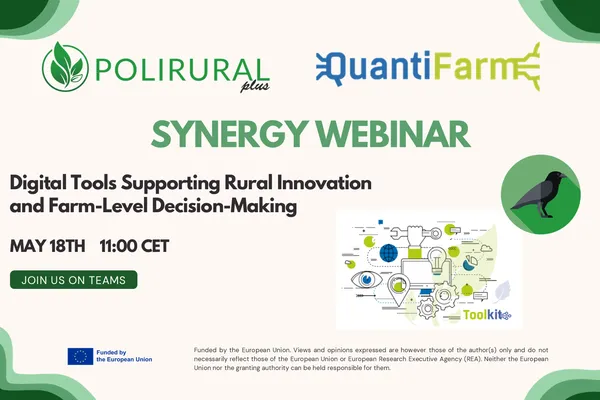
PoliRuralPlus x QuantiFarm Synergy Webinar
The PoliRuralPlus x QuantiFarm Synergy Webinar explored how digital tools developed within each project can transform agricultural and territorial data into practical insights for farmers, advisors, policymakers and rural communities.
26 de mayo de 2026 • Katerina Sachsamanoglou (GAIA EPICHEIREIN)
On the 18th of May, the EU-funded projects PoliRuralPlus and QuantiFarm joined forces for an online synergy webinar exploring how digital tools developed within each project can support farmers, advi
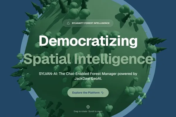
SYLVAN-AI: Validating JackDaw GeoAI for Sustainable Forestry and Land Management in Europe
26 de mayo de 2026 • Amir A. Zadpoor, Sylvanity B.V. (ENHANCE Open Call Winner)
Navigating Complex Forestry Data Europe's forests generate vast amounts of critical information, ranging from satellite imagery and land-use records to biodiversity maps and protected-area datas
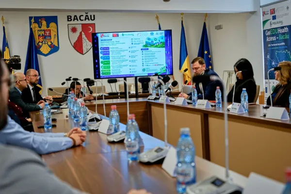
GeoEDUHealth Access Bacău: Validating JackDaw GeoAI for Territorial Accessibility in Rural Romania
19 de mayo de 2026 • Constantin Avrămescu, General Director & AI/GIS Expert, MEDIA TREND SRL | Alexandru-Norbert Droiman, Project Manager, MEDIA TREND SRL
The Context: Why Bacău County?The GeoEDUHealth Access – Bacău project is implemented by MEDIA TREND SRL as the only Romanian company selected under the ENHANCE cascade funding call within the PoliRur
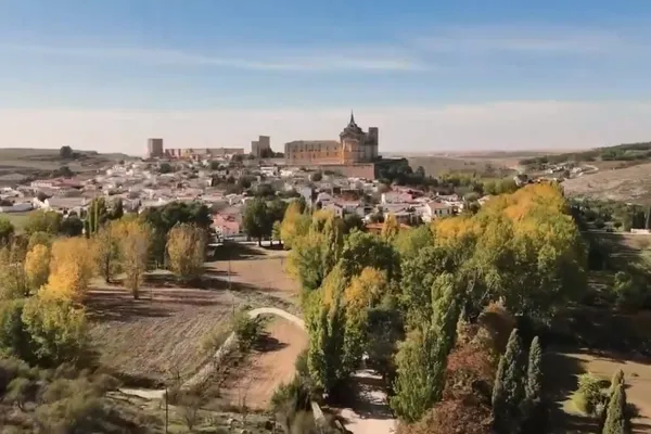
The PoliRuralPlus Spanish Pilot: Connecting Rural Territories Through CoCreation
How collaboration and local knowledge are driving rural innovation in the ADESIMAN territory
12 de mayo de 2026 • Julián Orden del Pozo
The Spanish pilot of PoliRuralPlus is being implemented in the ADESIMAN territory, a rural area that reflects many of the broader challenges currently faced by rural regions across Europe. Demographi
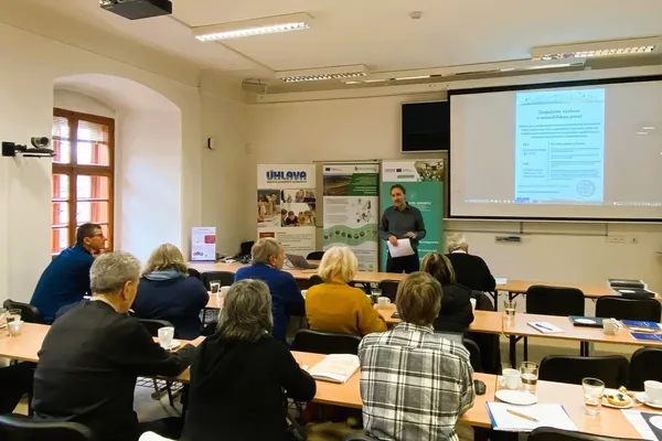
LocalLinks Presented in Klatovy: A Step Toward Smarter Regional Food Systems
This blog is based on the original Czech article published by Úhlava, o.p.s..
20 de abril de 2026 • LocalLinks.AI Team (DEVELOP Open Call Winner – Pilot 6, Bavaria–Czech Region)
On March 3, 2026, a regional meeting in Klatovy brought together farmers, experts, and innovators to explore how digital tools, education, and collaboration can better support agricultural practice.
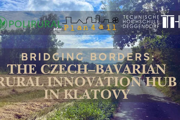
From border to bridge: The story of Klatovy’s Innovation Hub
1 de abril de 2026 • Markéta Kollerová
Where the forests of Šumava meet the Bavarian Forest, the landscape tells an old story, one of borders. But today, a new story is taking shape.And its centre is Klatovy. A small town, close to both P
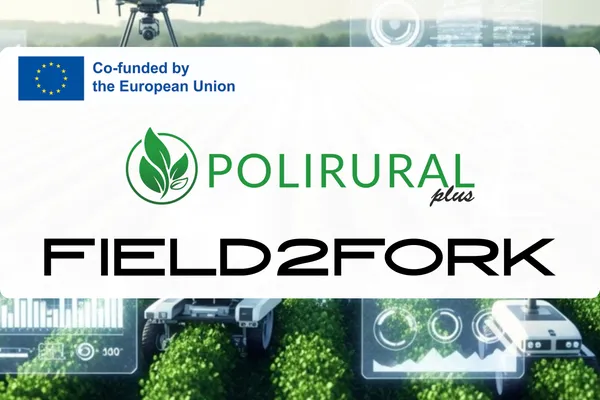
AI-Driven Short Food Supply Chains: The Field2Fork AI Hub Project Launches in Foggia
31 de marzo de 2026 • Field2Fork AI Hub team
An important co-design session for the future of local agriculture recently took place in Foggia. The focus group, organized by the DARe Puglia technological cluster in collaboration with EXO, brough
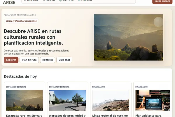
ARISE reaches mid-term milestone with public platform now online in Sierra y Mancha Conquense
A live prototype now connects heritage discovery, route planning, local businesses and digital guidance in the ARISE pilot territory.
23 de marzo de 2026 • Obsidian Innovation Institute
ARISE - Archaeological Routes for Inclusive Synergy & Entrepreneurship in Sierra y Mancha Conquense - has reached an important mid-term milestone with the launch of its public digital platform. I
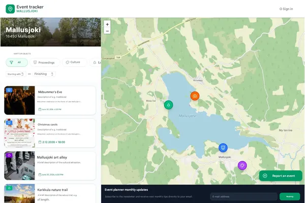
Digital services for the Rural Events and Activities ecosystem are under development for the Mallusjoki pilot region
16 de marzo de 2026 • Avoin Ry, Otso Valta
Cover image: A mockup by Annika Katter. Activity Map and Calendar is one of the services under development as part of the Avoin Map project for the Mallusjoki pilot region. One of the services curr
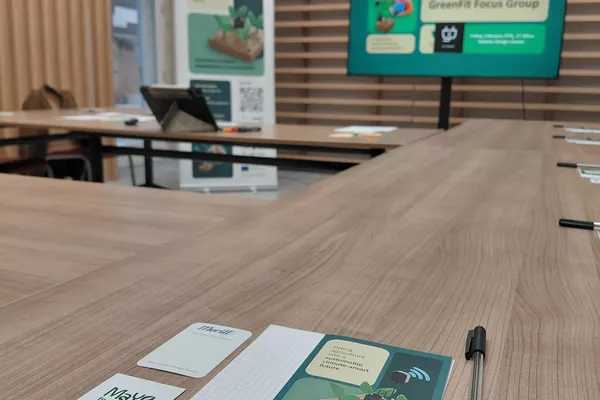
Creating Synergies to Support Malta’s Green and Digital Farming Transition
Potential Synergies with Greenfit Project
11 de marzo de 2026 • Maria Elena Muscat , Kayleigh Farrugia
Supporting greener farming in Malta through digital skills and practical trainingTowards the end of February 2026, the PoliRuralPlus Malta Pilot 9 Team at AcrossLimits participated in the GreenFit Pr