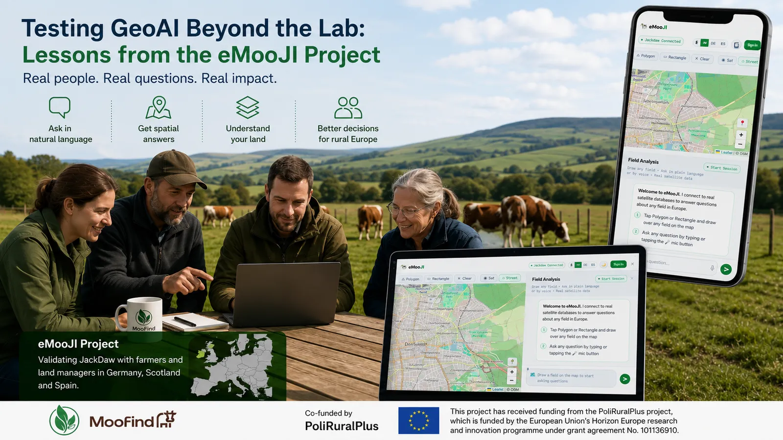
Artificial intelligence for geospatial analysis is advancing rapidly, but its value ultimately depends on whether real people can use it to solve real problems. During the six-month eMooJI project, funded through the PoliRuralPlus ENHANCE Call, MooFind validated the JackDaw GeoAI platform with stakeholders working in livestock farming, landscape management, and rural development across Germany, Scotland, and Spain.
Rather than evaluating GeoAI in a controlled laboratory environment, the project focused on understanding how people with different levels of technical expertise interact with spatial AI in their everyday work. The experience highlighted both the significant potential of conversational GeoAI and the practical improvements still needed before such systems become part of daily rural decision-making.
1 Why real-user validation matters
Most rural stakeholders already use maps and spatial information in some form, but relatively few are comfortable working with traditional GIS software or complex Earth Observation platforms. Farmers, advisors, and landscape managers often need answers rather than datasets.
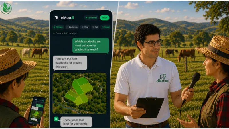
Natural-language interfaces such as JackDaw have the potential to lower this barrier by allowing users to ask questions in plain language and receive map-based answers supported by geospatial data. However, understanding whether users trust the responses, can interpret the outputs correctly, and find the information useful requires direct interaction with end users.
For this reason, eMooJI placed stakeholder validation at the centre of the project rather than treating it as a final demonstration activity.
2 How the validation was conducted
Validation combined guided demonstrations, individual testing sessions, remote meetings, and independent exploration of the platform. Instead of relying exclusively on workshops, participants were given flexibility to test the system in the way that best suited their availability. To support consistent testing, MooFind prepared:
- multilingual onboarding material;
- tutorials;
- a curated question bank covering typical agricultural and environmental use cases;
- structured feedback forms based on usability and project-specific evaluation criteria.
Participants were encouraged to explore practical questions related to vegetation, grazing suitability, protected areas, biodiversity, landscape management, and other spatial topics relevant to their daily activities.
Feedback was collected through various channels including emails, messages, online questionnaires as well as one-to-one discussions, allowing participants to explain not only what worked but also why certain answers were helpful—or confusing.
3 Who participated
Validation involved stakeholders from three European regions:
- Hesse (Germany)
- Aberdeenshire (Scotland)
- Catalonia (Spain)
Participants represented several stakeholder groups, including livestock farmers, farm advisors, landscape and conservation organisations, researchers, and rural innovation practitioners. This diversity helped evaluate the platform across different landscapes, farming systems, and professional perspectives while identifying feedback that was consistent across regions.
4 What worked well
Several positive patterns emerged throughout the validation activities. Participants generally appreciated the ability to ask spatial questions using natural language instead of navigating multiple GIS layers or specialised software. Voice interaction further reduced the learning curve for users with limited technical experience.
The polygon-based area selection allowed users to focus questions on their own areas of interest rather than predefined administrative boundaries, making the interaction more intuitive and relevant. Many users valued having multiple sources of spatial information accessible through a single conversational interface. The platform demonstrated how GeoAI can simplify access to Earth Observation data without requiring users to understand the underlying datasets or analytical methods.
Overall, participants recognised the potential of conversational GeoAI to support exploration of rural spatial information and to make complex geospatial data more approachable.
5 What remained difficult
The validation also identified several areas where further development is needed. Users occasionally experienced slow response times or temporary service interruptions during testing. Some complex questions returned incomplete answers or required additional clarification before meaningful results could be produced.
Region-specific expectations also highlighted the need for more local datasets and knowledge sources. While the platform performed well with general spatial questions, users expected answers that reflected local agricultural practices, regional terminology, and country-specific environmental information.
These observations reinforced that conversational interfaces alone are not sufficient; the quality and regional relevance of the underlying knowledge remain equally important..
6 Lessons for future rural GeoAI systems
The eMooJI project demonstrated that successful GeoAI adoption depends as much on user experience as on technical capability. Several key lessons emerged:
- Simple onboarding materials significantly improve user confidence.
- Voice interaction can reduce barriers for non-technical users.
- Local and regional knowledge substantially increases perceived usefulness.
- Transparent explanations and data provenance build user trust.
- Iterative validation with real stakeholders provides insights that cannot be obtained through technical testing alone.
Perhaps the most important finding was that rural stakeholders are willing to engage with AI-powered tools when they clearly support practical decision-making and are presented through accessible interfaces.
7 Open interoperable and transferable results
A core objective of the ENHANCE Call was to generate results that other organisations can reuse and build upon. Throughout the project, MooFind therefore focused on creating openly accessible resources alongside the software itself.
The eMooJI platform has been released as an open-source project, accompanied by a public repository and a reusable question bank that can support future GeoAI validation activities. The project also demonstrates a practical methodology for engaging stakeholders, collecting structured feedback, and evaluating conversational GeoAI across different rural contexts.
Interoperability was achieved through the JackDaw API and MCP servers, which allowed eMooJI to connect with the consortium’s services and external MooFind services. This modular approach supports the addition of new datasets and specialised tools without changing the core application. Figure below shows the high level architecture of the technical development during the Enhance Call.
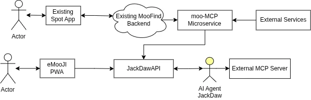
Fig: Interoperability of the emoji platform
The lessons learned extend beyond livestock farming. They provide practical guidance for future applications of GeoAI in agriculture, environmental management, biodiversity conservation, and rural planning throughout Europe.
As conversational AI continues to evolve, projects such as eMooJI show that meaningful innovation is achieved not only by developing better algorithms but by working directly with the people who will ultimately use them.
This project has received funding from the European Union's Horizon Europe research and innovation programme PoliRuralPlus.
PoliRuralPlus has received funding from the European Union’s Horizon Europe research and innovation programme under Grant Agreement No. 101136910. Views and opinions expressed are however those of the author(s) only and do not necessarily reflect those of the European Union or the European Research Executive Agency. Neither the European Union nor the granting authority can be held responsible for them.
Existující komentáře