The best validation evidence is not a questionnaire — it is a request. During the final phase of the AGROJACK project, more than a dozen farmers from the La Vera area joined informal on-farm sessions at the Aires de la Vera estate to see JackDaw, the PoliRuralPlus GeoAI agent, interpret live soil data in plain language. Three of them asked for the sensors to be installed on their own farms for a demonstration.
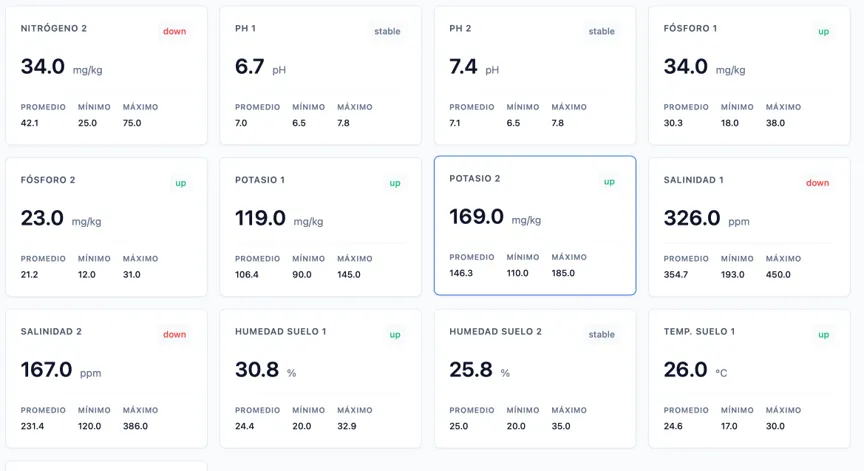
Figure 1 A sensor node probe values in Aires de la Vera farm
Why this matters for rural agriculture. Farms in La Vera, as across much of rural Spain, face a converging set of pressures: increasingly irregular rainfall, rising input costs, tighter environmental requirements and a generational renewal problem in which younger farmers expect digital tools as a matter of course. Precision agriculture promises answers, but its adoption among small and medium farms remains low — not because the sensors are unaffordable, but because the data they produce demands time and expertise most farmers do not have. AGROJACK attacked exactly that barrier: not the measuring, but the understanding.
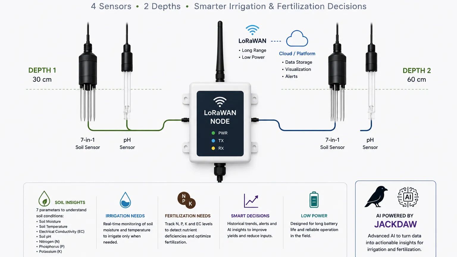
What the farmers saw. The demonstrations ran on AgroSens, Espacio SOA's multi-user environmental sensing platform, where each farm manages its own probes. At the Aires de la Vera estate it operates six LoRaWAN soil probes installed at two depths, measuring pH, electrical conductivity (EC), NPK nutrient levels, soil moisture, temperature and salinity. Two-depth measurement gives a picture of the root zone — is the water actually reaching where the trees drink? Is salinity building up below the surface? Are nutrient levels dropping where it matters? — while pH and electrical conductivity readings reveal conditions that silently limit how well crops can absorb nutrients.
In the sessions, farmers watched JackDaw answer questions such as when and how much to irrigate, or whether NPK levels justified fertilisation — with answers grounded in the real-time readings of the nearest sensor, enriched with JackDaw's own geospatial knowledge of terrain, land cover and local climatology. Rather than dashboards and charts, they received recommendations in conversational Spanish: the difference, several noted, between data they would have to interpret and advice they can act on. More than 15 agricultural interactions have been registered in the system during the validation, exceeding the project's target of 10.
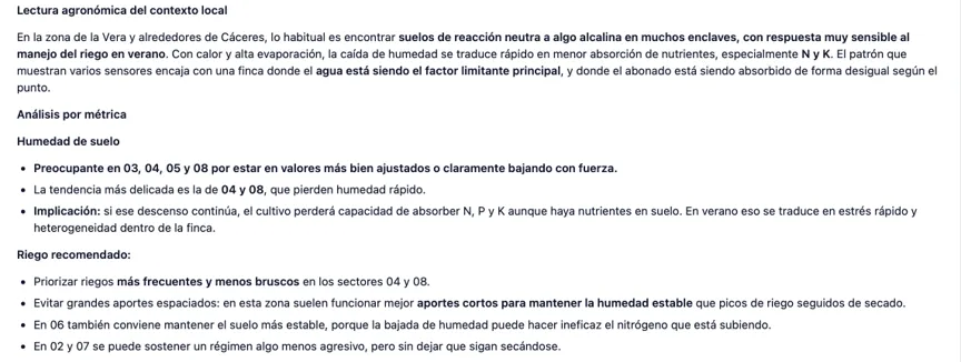
Figure 2 Agronomic recommendations from Jackdaw based on the above sensor values
From one estate to a territory. AGROJACK, run by Espacio SOA under the PoliRuralPlus Enhance Call, has documented this agricultural replication pathway in its public validation report: any farm with basic environmental sensors — or a cooperative operating a shared platform for its members — can connect to JackDaw using the project's openly described MCP integration pattern. And the barrier is low: as a multi-user platform, AgroSens lets neighbouring farms and cooperative members share the same infrastructure — each seeing their own plots and sensors. The three demonstration requests from neighbouring farmers will be the first to use it; the pathway will not stay on paper for long.
This project has received funding from the European Union's Horizon Europe research and innovation programme PoliRuralPlus.
PoliRuralPlus has received funding from the European Union’s Horizon Europe research and innovation programme under Grant Agreement No. 101136910. Views and opinions expressed are however those of the author(s) only and do not necessarily reflect those of the European Union or the European Research Executive Agency. Neither the European Union nor the granting authority can be held responsible for them.



Existing Comments