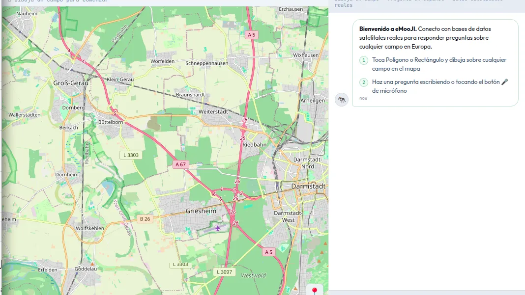
MooFind UG has completed the six-month eMooJI project, implemented from February to July 2026 under the PoliRuralPlus ENHANCE Call. The ENHANCE Call supported practical projects that apply, test and improve JackDaw, the GeoAI chat agent developed within PoliRuralPlus. JackDaw enables users to explore maps, spatial datasets and Earth Observation information through natural-language questions.
Through eMooJI, MooFind developed a progressive web application that extends access to JackDaw and makes its GeoAI capabilities more approachable for diverse stakeholders. The interface was designed for farmers, land managers, rural organisations, researchers and other users who may benefit from spatial information but do not regularly work with conventional Geographic Information System tools. The eMooJI application is available at:
A central feature of eMooJI is its multilingual interface, which enables users to interact with the platform in English, German and Spanish. The application also introduced several functions intended to improve accessibility and practical use:
- Voice-based interaction and question recording
- Polygon-based area selection on the map
- Dark mode
- The ability to save and export chat sessions for documentation and future analysis
These features allow users to define an area of interest and ask questions concerning topics such as vegetation conditions, grazing suitability, land use, protected areas, water resources and environmental risks.
The public source-code repository is available at: https://gitlab.com/moofind/emooji.git
During the project, the platform was tested by stakeholders from Scotland, Germany and Spain. Participants represented different rural contexts and included people working in farming, pasture management, landscape conservation, research and rural development. To support the testing process, MooFind prepared multilingual guidance materials explaining how to access and use the application. Participants were also provided with a sample question bank containing example prompts that could be adapted to their own regions and areas of interest.
The validation activities produced feedback on the usability, reliability, relevance and accessibility of the platform. Participants identified clear potential for conversational GeoAI to simplify access to map-based and Earth Observation information. The testing also highlighted areas where further development is required, including response speed, answer clarity, data availability, user guidance and the handling of complex or highly localised questions.
The results demonstrate the value of testing AI-supported spatial tools directly with rural users. They also show that regional applications may require additional local datasets and specialised services to provide more context-specific answers.
The eMooJI platform, its public source-code repository and the accompanying question bank contribute to the wider PoliRuralPlus objective of supporting open, reusable and transferable rural innovation. The project outputs can help other organisations explore how multilingual conversational interfaces can improve access to spatial data in different European rural settings.
This project has received funding from the European Union's Horizon Europe research and innovation programme PoliRuralPlus.
PoliRuralPlus has received funding from the European Union’s Horizon Europe research and innovation programme under Grant Agreement No. 101136910. Views and opinions expressed are however those of the author(s) only and do not necessarily reflect those of the European Union or the European Research Executive Agency. Neither the European Union nor the granting authority can be held responsible for them.



Existing Comments