A platform designed to absorb national knowledge
SYLVAN-AI is a chat-enabled forest manager, selected under the PoliRuralPlus Enhance Open Call to validate the JackDaw tool-using GeoLLM in one of the most data-intensive rural domains there is. A user draws a rectangle on a map, asks a question in plain language, and gets a spatially accurate, source-cited answer in seconds while there is no GIS training, no cross-referencing three or four national geoportals.
By June 2026 the platform stood on six grounding layers: 442,337,382 harmonised cadastral parcels across 27 countries, EEA Natura 2000, Copernicus terrain and land cover, ISRIC soil and NASA fire weather which is a 265 GB local foundation queried alongside JackDaw's own tools, with a guardrail that makes the assistant report missing data rather than invent it. That foundation gives the platform genuine pan-European reach: any parcel, in any member state, described in a single consistent vocabulary.
Continental datasets are built for exactly that, i.e. uniformity at scale. Alongside them sits a second kind of knowledge, held nationally, in classification systems maintained by national forestry institutes, which describe land in the terms local foresters actually use. SYLVAN-AI's hybrid retrieval architecture carries both: a continental base for universal coverage, and national layers that can be added incrementally for local precision. What it needed was a first national layer to prove that pattern. The Code Camp is where it found one.
Three days in Piraeus, and one specific ask
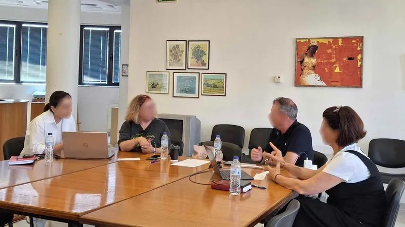
The PoliRuralPlus JackDaw Code Camp ran from 16 to 18 June 2026 in Piraeus/Athens, bringing together project partners, developers, researchers, Open Call winners and synergy projects for three days of technical collaboration. We presented SYLVAN-AI on the second day, in an online session on 17 June, within the programme of Cascade Funding project presentations and knowledge exchange.
The presentation covered the ground you would expect: the digital gap between Europe's abundant geodata and the small-scale owners who cannot reach it; the five guided journeys the platform ships with, i.e. the Compliant Owner, the Climate-Aware Planner, the Investor, the Conservationist and the Carbon Estimator; the hybrid retrieval architecture pairing JackDaw's GeoLLM with a local PostGIS grounding layer; the validation framework and KPI targets used to assess it.
Then we did the one thing that turned out to matter. Instead of closing on a summary, we closed on an invitation to the consortium: connect SYLVAN-AI with other pilots' data owners, share JackDaw's MCP-server roadmap, and co-define reference use cases that could be validated jointly.
A Code Camp audience is not a general public. It is the people who hold the data and build the tools. Time spent describing exactly what a platform can take in is worth considerably more than time spent describing what it already contains.
What arrived afterwards
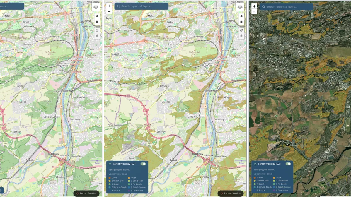
Karel Charvát, Project Manager and Representative of Plan4all within GEO and one of the key participants at the event, tested the platform himself after the Code Camp and confirmed that he found it a very interesting product. He also supplied the Czech national forest typology dataset published by ÚHÚL, the Czech Forest Management Institute, valid from 1 January 2025.
For anyone outside Czech forestry, it is worth explaining why that dataset is different in kind from a continental product. It is not land cover. Czech forest typology is a silvicultural classification: every forest site is described by a vegetation zone and an edaphic, or soil-moisture, category. Read together with the target species and management set recorded for the site, those codes tell you what belongs on that ground and how it should be managed.
That is national, domain-specific expertise encoded spatially which is the accumulated judgement of a forestry institute, expressed as geometry. It is precisely the layer no continental product can be made to yield, and one that JackDaw did not previously expose.
Building the seventh layer
Integrating it took SYLVAN-AI from six grounding layers to seven:
– 949,358 forest-site polygons covering 2.72 million hectares.
– Vegetation zone, edaphic category and target species decoded for each site.
– The Czech classification codes translated into English, so the layer is legible both to non-Czech users and to the language model reasoning over it.
– A toggleable overlay on the interactive map, so a user sees the typology alongside cadastre and protected areas rather than only reading about it.
– A reproducible loader following the same documented pattern as every other layer, with source, licence, vintage and coverage recorded in the project's data-provenance register.
A Czech forest owner can now ask what their site is classified as and which species it is suited to, and have that read alongside the cadastre, terrain, soil and protected-area layers already in place and an answer expressed in their own country's forestry system rather than in continental categories alone.
The value of the Czech layer is not only Czech. What it really delivered was the pattern.
A blueprint any country can follow
This is the part we would most like other partners to take away. Nothing about the Czech integration was Czech-specific in engineering terms. The work followed four steps that repeat anywhere:
- A national institute contributes an authoritative dataset. In this case ÚHÚL's forest typology; elsewhere it might be a soil survey, a forest-management register, a species inventory or a regional land-use plan. The essential requirement is provenance, not format.
- Local codes are decoded into plain, translated descriptions. National classification systems are compact and expert-facing by design. Decoding them makes the layer usable by non-specialists and by the language model reasoning over it.
- The layer is wired into the map and the retrieval path. A toggleable overlay plus geometry-keyed retrieval, so the layer answers questions rather than merely displaying.
- A reproducible loader and provenance record are written. Which is what makes step one cheap the second time.
Because the loader pattern and the five guided journeys are region-neutral, the next country should cost a fraction of the effort the first one did. Any PoliRuralPlus pilot, national institute or Open Call project holding a domain dataset for their own territory can have it integrated the same way — and the resulting layer serves every user of the platform, not only its contributor.
Our recommendation to the ecosystem is therefore concrete: if you hold a national or regional dataset that encodes local expertise, offer it. The integration path is now documented, tested and short.
Depth alongside breadth
The Czech layer also sharpened how we think about the roadmap. Continental coverage is what makes a platform available everywhere; national depth is what makes an answer actionable in one place. The two are complements, and the strongest version of SYLVAN-AI pairs them country by country.
The next layer along that path is national legal context, for example protected-area categories, harvesting regulations and seasonal restrictions, which are set in national legislation and are the natural companion to a national typology. Built once for a pilot country in a form that repeats, it would take the Compliant Owner journey from spatial evidence to full regulatory support. Localised framing of climate and fire-risk narratives follows the same logic: the same grounded data, expressed in terms that fit the country the user is standing in.
What goes back to the ecosystem
The Czech layer is not ours alone. It is a forestry-specific dataset that JackDaw did not previously expose, integrated through a documented loader pattern any partner can follow. Alongside it, the action returns the harmonised 27-country cadastral foundation behind a single query interface, and a systematic audit of the JackDaw endpoint surface compiled into a hardening backlog: renamed hosted-data endpoints, proxy errors on Eurostat-backed services, a catalogue search failing on every query, an upstream error that echoed a live third-party API key, and a profile endpoint slow enough to block sign-in. Each finding came with a client-side mitigation we implemented and an upstream remedy we recommended, i.e. one third party's real-world usage converted into an actionable list of improvements for the shared platform.
The part worth repeating
If there is a transferable lesson here for other projects working inside a larger ecosystem, it is not about GeoAI. It is that a Code Camp is not a dissemination channel.
The room contains people holding data no amount of engineering can substitute for. We arrived in Piraeus with a platform built to absorb national knowledge and left with the first national layer to prove it, because we spent the end of a presentation inviting rather than concluding. The invitation is still open, and now it comes with a worked example.
Further reading
The platform is live at sylvan-ai.com, accessible with a PoliRuralPlus account. The project was introduced in an earlier post, SYLVAN-AI: Validating JackDaw GeoAI for Sustainable Forestry and Land Management in Europe (26 May 2026), and its launch was announced here on 10 July 2026. The Athens event is reported in PoliRuralPlus JackDaw Code Camp Brings Innovation and Collaboration to Athens. The forest typology layer derives from the ÚHÚL national dataset valid 1 January 2025. SYLVAN-AI is delivered by Sylvanity B.V. under the PoliRuralPlus Enhance Open Call.
Funding acknowledgement
The project PoliRuralPlus has received funding from the European Union's Horizon Europe research and innovation programme under grant agreement No 101136910.
Disclaimer
Views and opinions expressed are, however, those of the author(s) only and do not necessarily reflect those of the European Union or the European Research Executive Agency (REA). Neither the European Union nor the granting authority can be held responsible for them.
Existing Comments