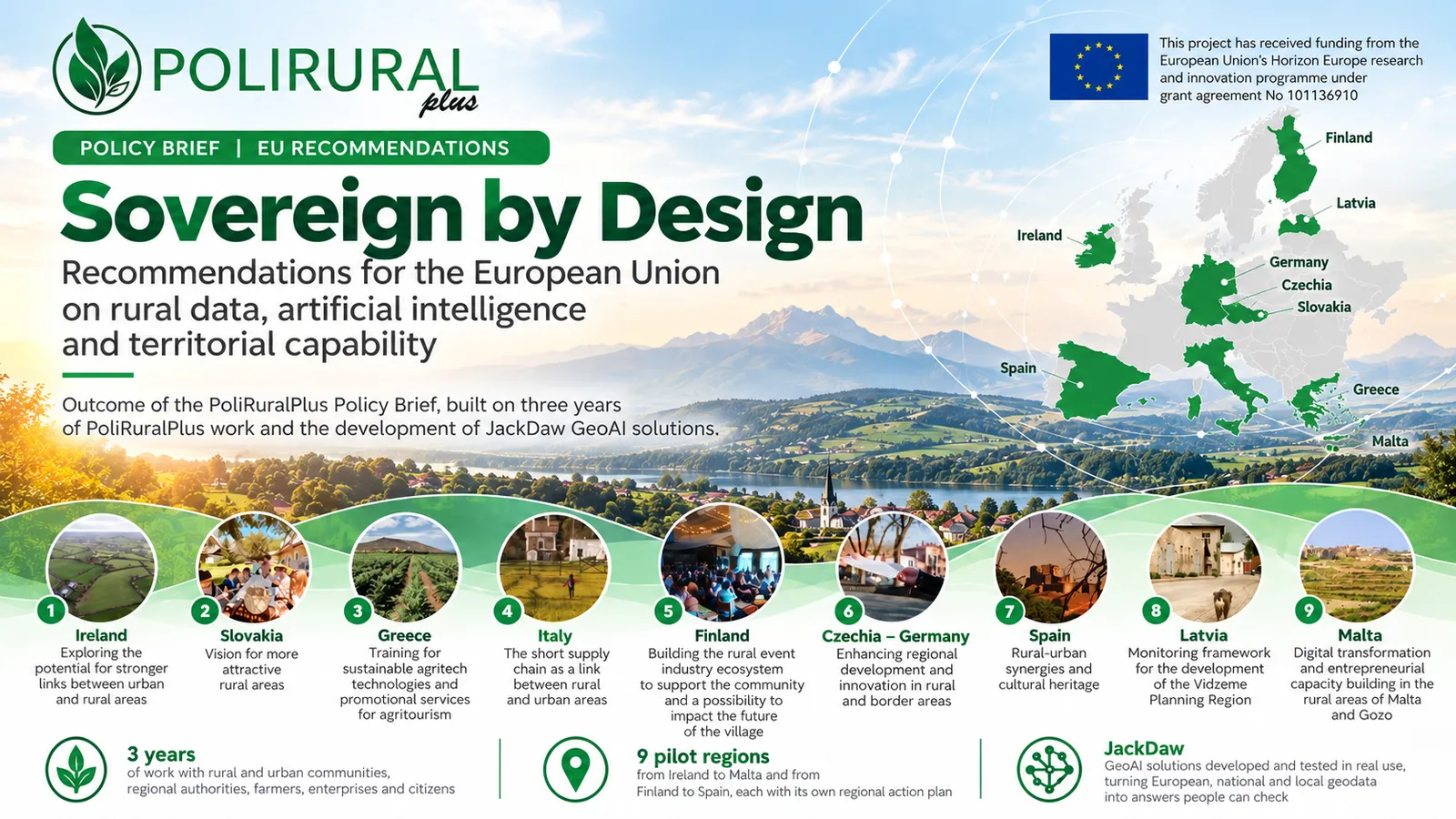
How can Europe ensure that artificial intelligence and digital technologies truly serve rural communities – not only during research projects, but long after they have ended?
This question is at the heart of “Sovereign by Design – Recommendations for the European Union on Rural Data, Artificial Intelligence and Territorial Capability”, a policy presentation prepared by Karel Charvát (Czech Centre for Science and Society – CCSS) and Pavel Kordík (Faculty of Information Technology, Czech Technical University in Prague).
The recommendations build on experience from nine PoliRuralPlus rural pilots across Europe, including the joint Czech–German cross-border pilot, and the development of JackDaw GeoAI.
Digital Sovereignty Is More Than Technology
The central message of the recommendations is simple:
“Sovereignty is a capability, not a location.”
Storing data in Europe is not enough. True digital sovereignty means that European institutions and rural communities can control their data, understand the AI technologies they use, verify their results and maintain digital services beyond individual project funding.
The recommendations highlight three essential principles:
- Control – clear ownership of data and models, transparency and the ability to change technology providers.
- Competence – people who can understand, question and verify AI-generated information.
- Continuity – sustainable digital services with long-term responsibilities, maintenance and financing.
Seven Recommendations for European Policymakers
The PoliRuralPlus Policy Brief identifies seven priorities for strengthening Europe's rural digital future, ranging from enforceable data sovereignty and European technological capabilities to AI literacy, reliable geospatial information and long-term financing.
It also proposes a five-gate sovereignty test to assess whether digital services are ready for wider deployment: they should be accountable, portable, proven, supported by competent users and durable.
The recommendations draw on practical experience from the project's nine rural pilots, reflecting different territorial challenges and local needs. They demonstrate how digital innovation can support rural communities while ensuring that public authorities and local stakeholders retain meaningful control over the technologies they use.
From JackDaw GeoAI to Practical Policy Recommendations
The development of JackDaw, the conversational GeoAI assistant within PoliRuralPlus, has contributed to the project's understanding of how artificial intelligence can make complex geospatial information more accessible.
At the same time, the project experience highlights the importance of trustworthy data sources, transparency, local knowledge and human involvement in decision-making.
The proposed recommendations translate these lessons into a practical agenda for European policymakers, public authorities and regional stakeholders.
Europe should scale only what it can control, understand and sustain.
Explore the Full Recommendations
The complete presentation provides a detailed overview of the seven policy recommendations, the five-gate sovereignty test, specific recommendations for all nine PoliRuralPlus pilots, and a proposed implementation roadmap.

Existing Comments