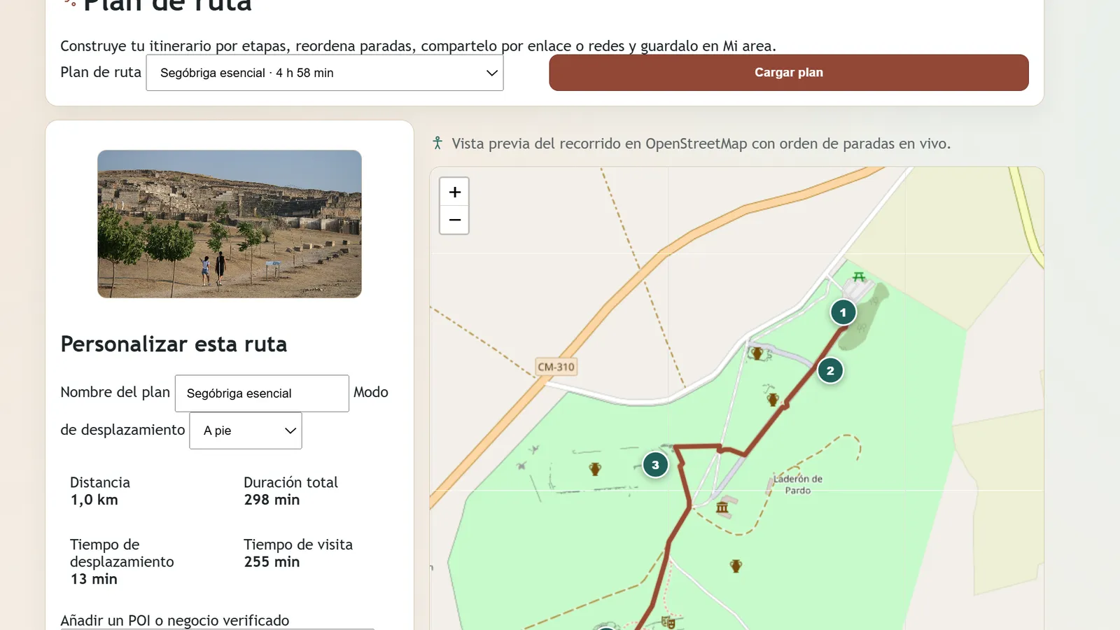
ARISE - Archaeological Routes for Inclusive Synergy & Entrepreneurship in Sierra y Mancha Conquense - has completed its nine-month implementation period within PoliRuralPlus and delivered a live digital service for the pilot territory. The platform is publicly available at https://arise.xilbi.com/ and brings together heritage discovery, route planning, rural-business visibility, territorial information and location-aware guidance in one integrated environment.
The project addressed a clear rural-development challenge. Sierra y Mancha Conquense contains major Roman archaeological assets, particularly Segóbriga, Valeria and Ercávica, but visitor information, local services and territorial coordination were fragmented. This limited the ability of the heritage network to support longer visitor journeys, wider local-business exposure and more coordinated action among territorial stakeholders.
Obsidian Innovation Institute - Associação and Xilbi Sistemas de Informacion SL developed ARISE as more than a conventional tourism website. The public platform allows users to explore points of interest on an interactive map, discover rural businesses, create multi-stop itineraries, access territorial news and funding opportunities, save route plans and interact with the ARISE Chat Agent powered by PoliRural Jackdaw. The service is available in Spanish, English and Portuguese.
The visitor-facing service is complemented by a restricted operational environment. Authorised users can manage businesses, routes, news, funding initiatives, promoted content and integrations, while the authenticated MAAT workspace supports stakeholder records, initiatives, tasks, route co-design, KPI and New European Bauhaus monitoring, meeting information and shared working resources. This structure connects public discovery with the operational functions required to keep the platform current and useful.
Final monitoring confirms that the project met or exceeded all nine approved KPIs. ARISE registered 48 stakeholders in MAAT and listed 63 rural businesses. The platform reached 1,286 monthly unique visitors, with an average active-session duration of 5 minutes and 18 seconds and a user-satisfaction result of 4.4 out of 5. Users created 148 itineraries, while 17 collaborative planning or workspace sessions were recorded. Five structured dataset packages covering businesses, points of interest, routes, news and events, and audiovisual resources were prepared for PoliRuralPlus-oriented reuse, comprising 199 reviewed territorial records. The digital-first information model produced an estimated 138 kg CO₂e saving compared with the equivalent use of printed visitor brochures.
The technical result is a functioning and maintainable pilot deployment. ARISE uses a Laravel-based architecture, Leaflet and OpenStreetMap geospatial interfaces, structured data models, public and authenticated APIs, OpenAPI documentation and server-side connections to external services. The Jackdaw integration uses the geographical area selected by the user to provide spatially contextualised guidance without exposing service credentials or access tokens in the browser.
Quality and public credibility were central to the final implementation. The consortium strengthened multilingual coverage, content realism, image provenance, legal and privacy information, public contact functions, internal-link reliability and release testing. The documented validation baseline includes 94 automated tests and 1,007 assertions covering public journeys, administration, stakeholder functions, APIs, integration behaviour, privacy controls and public discoverability.
ARISE also provides a practical contribution to the wider PoliRuralPlus ecosystem. It demonstrates how Jackdaw-supported guidance, multi-actor collaboration, structured territorial data and rural-business promotion can be adapted to a cultural-heritage setting. The platform connects visitor services with stakeholder coordination and provides documented interfaces that support controlled reuse and future data exchange.
The project concludes with a sustainability and replication basis as well as a live service. The production platform can continue to support Sierra y Mancha Conquense, while a reusable public software distribution and technical documentation allow the model to be adapted to other rural areas. The distribution is separate from the live deployment and excludes production data, personal information, credentials and environment-specific configuration. Replication primarily requires new territorial data, routes, businesses, branding, languages and stakeholder structures rather than redevelopment of the complete platform.
ARISE therefore leaves a concrete project legacy: a publicly accessible heritage and rural-service gateway, an operational stakeholder workspace, measurable user and business uptake, documented technical foundations and a transferable model for heritage-led rural innovation. The final result shows how digital tools can connect cultural assets, local enterprise and multi-actor governance to strengthen rural attractiveness and rural-urban cooperation.
The ARISE platform is available at: https://arise.xilbi.com/
Project repository: https://github.com/obsi-org/ARISE
Funding acknowledgement
PoliRuralPlus has received funding from the European Union’s Horizon Europe research and innovation programme under Grant Agreement No. 101136910. Views and opinions expressed are however those of the author(s) only and do not necessarily reflect those of the European Union or the European Research Executive Agency. Neither the European Union nor the granting authority can be held responsible for them.


Existing Comments