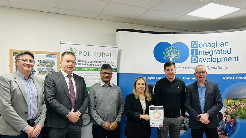
The PoliRuralPlus consortium is pleased to announce the six winning projects selected under the Develop Open Call, launched earlier this year to support innovative digital applications that strengthen rural–urban linkages across Europe.
Building on the momentum of previous open calls, Develop focuses on applied innovation - funding small-scale projects that turn promising ideas into interoperable, field-tested solutions. The selected projects, chosen from a highly competitive pool of applications, demonstrate outstanding potential to contribute to sustainable, inclusive and data-driven rural development in line with New European Bauhaus values.
Over the next nine months (October 2025 – June 2026), each team will collaborate closely with PoliRuralPlus partners and pilot regions to design, test, and demonstrate their digital innovations.
The Winning Projects
1️⃣ ARISE – Archaeological Routes for Inclusive Synergy & Entrepreneurship
Pilot Region: Sierra y Mancha Conquense (Spain)
Lead Organisation: Obsidian Innovation Institute – Associação (PT)
Partner: XILBI (ES)
ARISE proposes an interoperable digital ecosystem connecting the Roman parks of Segóbriga, Valeria and Ercávica into a single, data-driven heritage corridor. The project integrates a mobile-first web app, multi-actor collaboration portal, and advanced modules such as Map Whiteboard, Jackdaw GeoAI, and analytics linked to the PoliRuralPlus Hub. The result will be a “Heritage Synergy Platform” supporting cultural tourism, entrepreneurship, and inclusive governance across rural Spain — a scalable model for heritage-led rural regeneration.
2️⃣ Avoin-Map – Open-Source Spatial Tools for Smart Rural–Urban Development
Pilot Region: Mallusjoki (Finland)
Lead Organisation: Avoin Map Oy
Partners: Feydec Oy, Saatsi Arkkitehdit Oy (FI)
Avoin-Map will deliver an open-source spatial planning platform integrating event coordination, cultural heritage mapping, and climate-smart infrastructure planning. Co-designed with local stakeholders, the tool promotes rural–urban connectivity and supports municipalities, SMEs, and citizens in data-informed decision-making. Built on modular, interoperable architecture, Avoin-Map reflects the New European Bauhaus principles through an intuitive and engaging user experience.
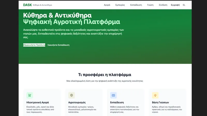
3️⃣ DASK – Digital Agricultural Skills and Knowledge for Kythera
Pilot Region: Central Greece (Kythera & Antikythera Islands)
Lead Organisation: DASKALOS APPS (FR)
Partners: Kytherian Foundation for Culture & Development, Environmental Consulting (EL)
Addressing the digital divide in Greece’s island farming communities, DASK combines the PoliRuralPlus E-Market with the Jackdaw GeoAI Chatbot to create an integrated platform for product sales, agritourism promotion, and AI-powered training in sustainable agriculture. Through collaboration with local cooperatives and more than 20 pilot farmers, DASK will empower producers with digital literacy, new market access, and tools for sustainable growth.
4️⃣ Field2Fork AI Hub – Bridging Apulia’s Rural Roots and Urban Markets
Pilot Region: Apulia (Italy)
Lead Organisation: EXO Soc. Cons. a r.l.
Partner: Distretto Agroalimentare Regionale S.C.R.L. (IT)
Field2Fork AI Hub enhances short food supply chains by connecting urban consumers with rural producers through an AI-driven “Personal Farmer” chatbot and integration with the PoliRuralPlus E-Market. The platform personalises shopping choices based on ethics, sustainability, and dietary preferences while leveraging IoT monitoring, GIS logistics, and co-governance mechanisms. The result: healthier consumer options, fairer market access for producers, and a replicable model for resilient local food systems.
5️⃣ LocalLinks.AI – Smart Mapping and Activation of Short Food Supply Chains in Rural -Urban Regions
Pilot Region: Czech–Bavarian Border Region
Lead Organisation: Šumavaprodukt s.r.o.
Partner: Jan Strouhal, Úhlava, o.p.s. (CZ)
LocalLinks.AI introduces an interactive digital tool to map and maintain producer–buyer relationships in short food supply chains. By combining AI-driven data collection, participatory mapping, and integration with PoliRuralPlus tools such as Jackdaw and Vulture, the platform strengthens rural-urban economic linkages and supports transparent, sustainable food ecosystems. Its connection to the Atlas of Best Practices ensures cross-regional visibility and scalability.
6️⃣ MALTESE – Malta Agro-Leadership & Tech Entrepreneurship for Sustainable Empowerment
Pilot Region: Malta & Gozo
Lead Organisation: Projektberatung und Management Expert Association (AT)
Partner: SEMABLU (MT), Selfhood Oktató és Szolgáltató Nonprofit Korlátolt Felelősségű Társaság (HU)
MALTESE promotes digital innovation, youth leadership, and circular entrepreneurship in Malta’s rural areas. The project integrates Jackdaw GeoAI, Map Whiteboard, and a Rural-Urban E-Market to support new agri-businesses and eco-friendly value chains. Through targeted digital training and co-design workshops, MALTESE will empower rural youth and entrepreneurs to create sustainable, inclusive business models aligned with EU green transition goals.
Looking Ahead
The Develop Open Call winners will now embark on their implementation phase, working closely with PoliRuralPlus partners and pilot coordinators to test and refine their solutions in real environments.
Their work will contribute to the PoliRuralPlus Knowledge Space, strengthening Europe’s capacity to bridge rural–urban divides through technology, collaboration, and creativity.
Follow PoliRuralPlus social media channels and visit www.poliruralplus.eu for updates on their progress and details about upcoming webinars on digital tools and open collaboration opportunities.
This initiative is funded through the PoliRuralPlus Financial Support to Third Parties (FSTP) scheme under the Horizon Europe programme, supporting small-scale innovators contributing to sustainable rural–urban development.


Existing Comments