
At a glance: the Athens development sprint converted a developer-dependent setup into a MALTESE-branded, mobile-responsive GeoAI service with automatic authentication, automatic MCP connection and data-backed tools for soil, moisture, funding and protected areas.
Background: a digital hub designed for rural Malta
MALTESE, short for Malta Agro-Leadership & Tech Entrepreneurship for Sustainable Empowerment, is developing an Agro-Innovation Digital Hub for farmers, young people, entrepreneurs and rural stakeholders in Malta. The wider prototype brings together three components: the JackDaw GeoAI Chatbot, the Map Whiteboard and the Rural-Urban E-Market Platform. Together, they are intended to support precision agriculture, participatory planning and more direct links between rural producers and urban markets.
Within that suite, JackDaw provides the location-aware advisory layer. A user can select an area on a map and ask about soil, irrigation, protected sites or funding. JackDaw then calls the relevant tool, retrieves location-linked information and returns a structured response.
This approach uses Retrieval-Augmented Generation, or RAG, which retrieves evidence before an AI produces an answer. GeoRAG adds spatial filtering, while the Model Context Protocol, or MCP, lets JackDaw discover and call external functions. The result is a chatbot that can work with evidence and tools rather than relying only on general model knowledge.
Why the Athens Code Camp mattered
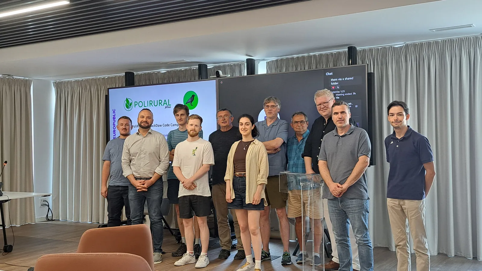
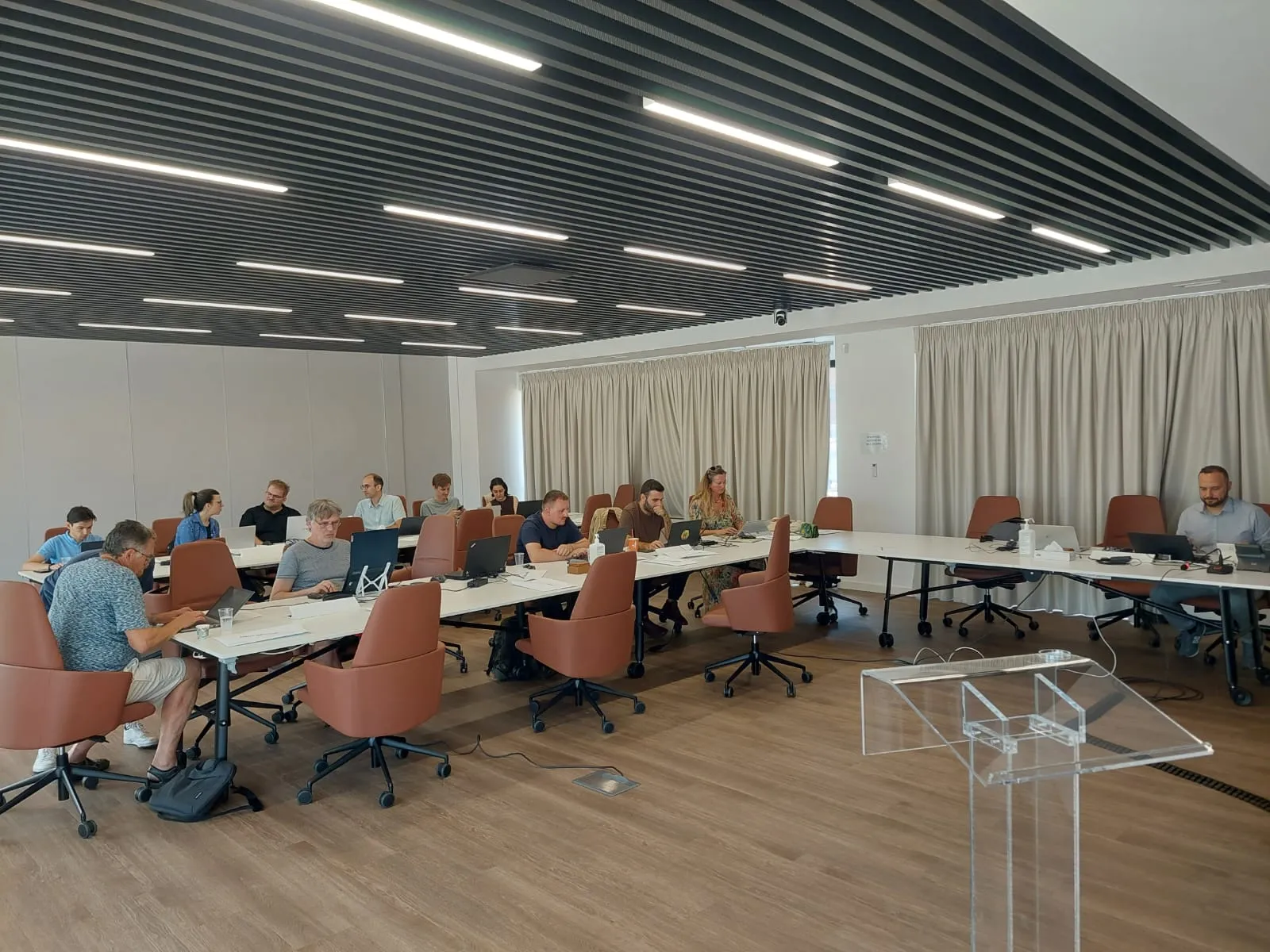
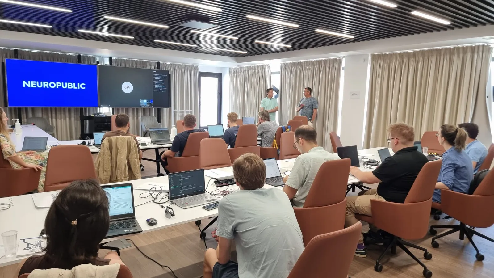
The PoliRuralPlus JackDaw Code Camp took place from 16 to 18 June 2026 at NEUROPUBLIC's headquarters in Piraeus, Greece. It brought together project partners, developers, researchers, Open Call winners and innovators for three days of technical collaboration. MALTESE was represented by Dr. Eng. Daniel Amariei - PAMEA and Jan Formosa - SEMABLU. The event focused on MCP tools, RAG and GeoRAG workflows, natural-language map interaction, pilot data and interoperable services. For MALTESE, it was a development sprint used to test assumptions, address implementation barriers and turn an early setup into a more usable pilot application.
Before this work, access to the MALTESE functions depended on several manual steps. Each user needed a JackDaw account, a locally running Python server and a manually configured MCP connection. Those requirements were manageable for developers. They were unsuitable for farmers, entrepreneurs and other users who should not need to understand server ports, tokens or connection settings before asking a question about their land.
Improvement 1: Dedicated MALTESE web interface
The most visible improvement was the creation of a dedicated MALTESE GeoAI web application. Built with Next.js 15, TypeScript and Tailwind CSS, the interface follows a simple two-panel model. A chat panel allows users to ask questions in natural language and receive formatted answers. A Leaflet map allows them to draw a rectangle around an area of interest, review its coordinates and clear or redraw the selection.
This design keeps the spatial context visible during the conversation. Markdown formatting, lists and clickable links make structured results easier to scan. The MALTESE-branded interface can also be opened without requiring each user to create a separate JackDaw account. The change is more than cosmetic. It shifts the prototype from a developer-facing demonstration to a service that can be introduced during training, testing and stakeholder engagement. The user sees a map, a question box and a response. The authentication and tool connection work happens behind the interface.
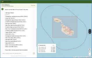
Figure 1. MALTESE GeoAI interface combines area selection with natural-language questions and structured answers. Source: SEMABLU, MALTESE Agro-Innovation Digital Hub Prototype, July 2026.
Improvement 2: Automated authentication and MCP connection
The work addressed the main technical barrier behind that simplified experience. The application now authenticates on the server side using the OAuth2 client-credentials flow. When the service receives its first request, it obtains a Bearer token from the PoliRuralPlus token endpoint. The token is cached, reused and refreshed before expiry. The presentation prepared for Athens reports a validity period of approximately ten hours.
The application also registers the SEMABLU MCP server automatically at the start of a new chat. Previously, a user had to open JackDaw settings, enter the server address and connect it manually on every visit.
The new API layer sends the MCP connection request in the background. By the time the user asks a question, the relevant MALTESE tools are available to the session. This reduces configuration errors: the system handles credentials and service registration, while the user concentrates on the agricultural or rural-development question.
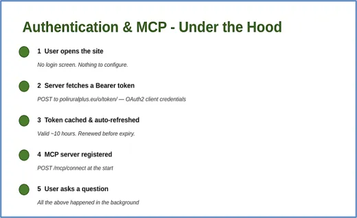
Figure 2. Server-side authentication and MCP registration now happen in the background before the user asks a question. Source: MALTESE Athens Code Camp presentation, June 2026.
Improvement 3: Replacing placeholder functions with data-backed tools
The MCP server was also upgraded so that its domain functions return more meaningful and structured results. Three changes illustrate the difference between the early prototype and the post-Athens version:
- Soil type: The earlier function contain three hardcoded soil categories and was not operational. The improved tool reads an Environment and Resources Authority GeoJSON layer containing 383 polygons and 18 soil classifications. For a selected area, it calculates area-weighted percentages rather than returning a single generic label.
- Soil moisture and irrigation: The previous function always returned a hardcoded yes. The improved version reads timestamped EWA sensor data from a CSV file and compares volumetric water content with a 25% threshold. This makes the output data-based, although live streaming from field sensors remains a next-stage task.
- Funding information: The early output was plain text without links or deadline awareness. The revised function uses structured entries, includes links and filters opportunities according to deadlines, making the result more useful for farmers and rural entrepreneurs.
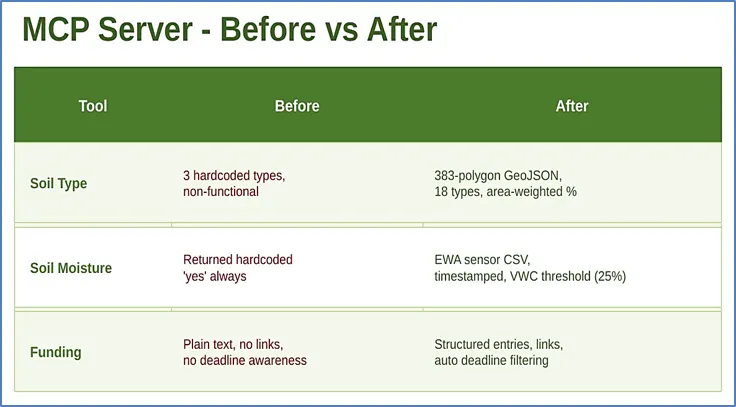
Figure 3. The Athens presentation summarised the main before-and-after changes in the MALTESE MCP tools.
Source: MALTESE Athens Code Camp presentation, June 2026.
Improvement 4: protected-area guidance and mobile access
The prototype was extended with a function that can inform users about Natura 2000 and other protected sites. This matters because land management decisions are shaped not only by soil and moisture conditions, but also by legal and environmental constraints. Bringing protected-area information into the same location-aware interface can help users identify issues earlier and seek the relevant detailed guidance.
The interface was also adapted for mobile devices. On smaller screens, the desktop two-panel layout becomes a tab-based system. Users can switch between the map and chat, while indicators show whether an area has been selected and whether messages are available. This is an important design choice for field use, where a phone is more likely to be available than a desktop computer.
Mobile responsiveness does not prove ease of use, but it removes a device barrier and provides a stronger basis for field testing.
How the improvements support the wider MALTESE prototype
The Athens improvements focused mainly on the JackDaw component, but they strengthen the wider Agro-Innovation Digital Hub. The Map Whiteboard supports participatory mapping and community planning. The Rural-Urban E-Market supports producer profiles, product listings and direct market connections. A more usable GeoAI interface can provide the advisory and data layer that links these activities.
Soil layers and sensor locations can support planning exercises, while JackDaw advice can inform discussions about irrigation, land use or infrastructure. Funding results can help users pursue ideas developed through the Map Whiteboard. Stronger interoperability can therefore turn separate tools into a connected workflow. The technical documentation places JackDaw at Technology Readiness Level 5 and targets TRL 7 through operational demonstration. The Athens work supports that progression by addressing deployment, access, data integration and
user interaction.
Outcomes: what improved and what still needs to be measured
The post-Athens prototype provides several concrete implementation outcomes:
- Three user setup requirements removed from the normal journey: individual login, local Python-server operation and manual MCP registration.
- One MALTESE-branded web interface created for map selection and natural language questions.
- A soil dataset expanded from three hardcoded categories to 383 geospatial polygons covering 18 classifications.
- A moisture recommendation changed from a fixed response to timestamped measurements evaluated against a defined 25% volumetric-water-content threshold.
- Funding answers changed from unstructured text to linked, deadline-aware entries.
- Responsive mobile interaction added through separate map and chat tabs.
- A protected-sites function added to support awareness of Natura 2000 and other regulated areas.
Next steps
The improvements establish a stronger technical baseline. The next phase should focus on use in Malta: structured testing with farmers, young entrepreneurs and trainers; validation against authoritative sources; and usability feedback in Maltese and English.
The soil-moisture function should also progress from timestamped file-based readings towards dependable live sensor ingestion. SEMABLU has outlined the architecture in which soil-moisture, temperature and luminance data move through a local Wi-Fi network to an MQTT broker, a Python backend and a database before becoming available to the MCP server. Implementing and validating that flow would support more timely irrigation advice and clearer data provenance.
Further work will strengthen error handling, monitoring and update procedures. Formal indicators should cover response time, successful tool calls, data freshness, answer correctness, mobile task completion and user satisfaction. These measurements would show how the service performs under real conditions.
The project can also deepen integration with the Map Whiteboard and Rural-Urban E-Market, helping users move from evidence and advice to planning and market action. The aim is not an isolated chatbot, but a pathway from place-based information to decisions and rural opportunity.
The Athens JackDaw Code Camp helped MALTESE take a meaningful step along that pathway. By removing technical setup from the user journey, automating the connection to JackDaw, improving the underlying tools and supporting mobile access, the prototype became more credible as a service for real rural users.
References and source material
- MALTESE Project. MALTESE Project Participates in the PoliRuralPlus JackDaw Code Camp in Athens
- PoliRuralPlus. PoliRuralPlus Jackdaw Code Camp Brings Innovation and Collaboration to Athens
- PoliRuralPlus. Join the PoliRuralPlus JackDaw Code Camp in Athens
- MALTESE. MALTESE GeoAI Interface - Prototype Development Summary, Athens Code Camp presentation, June 2026
- SEMABLU. MALTESE - Agro-Innovation Digital Hub Prototype, Work Package 2 technical description, July 2026
Related links
Funding acknowledgement
The project PoliRuralPlus has received funding from the European Union's Horizon Europe research and innovation programme under grant agreement No 101136910.
Disclaimer
Views and opinions expressed are, however, those of the author(s) only and do not necessarily reflect those of the European Union or the European Research Executive Agency (REA). Neither the European Union nor the granting authority can be held responsible for them.
Existing Comments