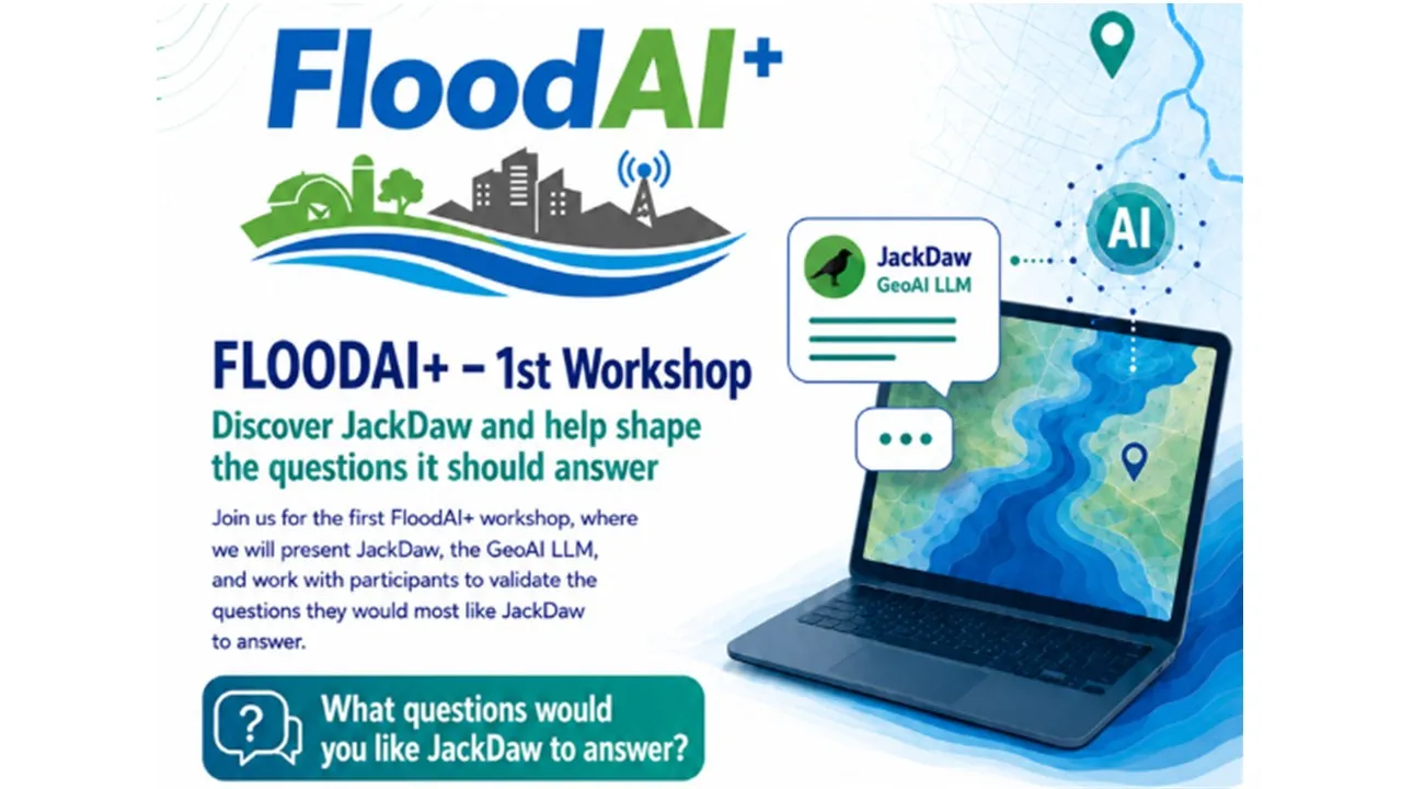
FloodAI+ held its first online workshop, dedicated to presenting JackDaw, the GeoAI LLM developed to support flood-risk information, and to collecting feedback from stakeholders on the questions they would most like JackDaw to answer.
The workshop introduced the FloodAI+ project and explored how GeoAI and conversational artificial intelligence can help make complex flood-risk information easier to understand and use. Flood-risk data often includes maps, satellite data, GIS layers and vulnerability models, which can be difficult for non-specialist users to interpret. FloodAI+ aims to validate and enhance JackDaw as a multilingual conversational interface capable of helping users ask natural-language questions about flood exposure, geospatial information and resilience planning.
During the session, participants were invited to reflect on the types of questions that matter most in real flood-risk contexts. These included questions such as which areas are most exposed to flooding, how to explain risk maps to non-technical colleagues, what roads, fields or assets may be affected, how different locations compare in terms of hazard or vulnerability, and what data should be checked before deciding on adaptation measures.
The workshop was designed as a practical validation activity, combining a presentation of FloodAI+, a live demonstration of JackDaw and structured feedback collection. The feedback gathered will help the project team assess usability, reliability, trust, usefulness and the added value of JackDaw for decision-making and stakeholder participation.
FloodAI+ is particularly relevant for municipalities, civil protection authorities, infrastructure managers, farmers and farmers’ organisations, SMEs, NGOs, researchers and citizens interested in flood-risk management, territorial resilience and AI-supported decision-making.
To continue an asynchronous validation process, the project invites the public and interested stakeholders to watch a demo video and share their feedback on JackDaw. The wider the participation, the more useful the feedback will be for improving JackDaw and ensuring that it responds to real user needs.
Share your feedback here:
https://www.menti.com/al6mjpraoxci
The contributions received will support the improvement of JackDaw’s templates, glossary, user journeys and future validation activities, helping FloodAI+ strengthen the role of GeoAI tools in supporting flood resilience decisions.
For more information, please contact:
Ana Silva, Principal Investigator, FloodAI+ - as@porvalor.pt
Oliver Crespo, R&D Manager, Porvalor - oc@porvalor.pt
FloodAI+ Team
The FloodAI+ project is funded by PoliRuralPlus initiative, funded by the European Union, which aims to foster innovation and collaboration in rural and regional development.

Existing Comments